Canning Stock Route (Walk) 1600kms. 1990
As part of my Around Australia 24,000km walk, run, cycle and kayak the Canning Stock Route was a part of the journey. I had just paddled 800kms from Augusta to Geraldton and cycled 810kms from Geraldton to Wiluna but the Canning Stock Route walk was probably going to be a lot more difficult due to a leg/knee injury I had for several months and this would be the first time that I have had an opportunity to put it under any real strain.

Paddled 800kms from Augusta to Geraldton. Now I’m about to cycle 810kms to Wiluna and then walk the 1,600km Canning Stock Route.

Walking the Canning Stock Route.


Some wells contained fresh water others didn’t.

It was always good to use the water from the wells to wash.


The track varied from corrugations, huge sand dunes, rock terrain, salt flat and soft sand.

Breakaway Country.

I cycled into Wiluna just before 3.00pm. It wasn’t the cleanest town, in fact it was a sad and sorry sight to see the Aboriginals drinking by the roadside. We topped the vehicle up with diesel as it was going to be the last time we could fill it before reaching our fuel drum that would be waiting for us 800 kms along the Canning Route.
Before moving to the campsite which was quite deserted, I rang the ABC radio and informed them of my plans and then visited the police station to do likewise.
June 30th 1990. Wiluna.
Before taking off along the stock route we drove out to Lake Violet, which was a refuge for several black swans. A mining concern was also in the area. Then we shot off to the orange farm to buy enough oranges to keep us going for a week or two. We were greeted by Kiwi, Kevin Murphy and his wife who gave us a box of the Desert Gold oranges for $10 and then he gave us another box for good luck. He told us that the farm had been deteriorating over the last few years and he had just received a grant to build it up again.
Back in town, I phoned Bill Shepherd in Newman to make sure that our fuel for the second half of the Stock Route was going to be at the half way mark. I also phoned the ‘Sunday Times’ newspaper and my wife Jenny.
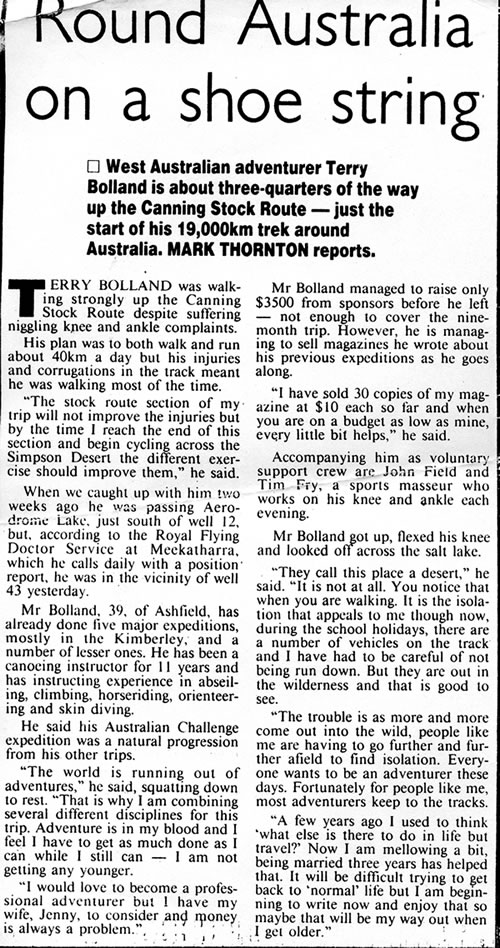
I left the small town of Wiluna, which had many social problems at 11.15am, and with a Mars Bar in hand, I started my run from the post office. It was like running into nowhere. Only the desert was ahead of me – no towns, no service stations, nothing for 1,600 kilometres. Having been injured for so long, and having done virtually no running for months, I wondered how I was going to cope. I needed to average about 60 kilometres a day to keep on schedule, but would my legs stand up to the test? I knew if I could conquer this next 1600 kms, I would have no problems completing the rest of the trip.

Leaving Wiluna Post Office.
The Canning Stock route is a rough track that meanders north through very remote, inhospitable country from Wiluna to the East Kimberley area. The East Kimberley area was settled by cattlemen in the 1880’s. They travelled thousands of kilometres from all over Australia to open up the country and establish cattle stations. Soon after, the station owners needed to find a way of getting their cattle to the markets and the population in the south. It was in 1906 that the State Secretary for Mines, H.S. King appointed Alfred Canning and an eight man team to survey a route from Wiluna north to the Kimberley region in the hope of establishing a stock route. He returned in 1908 to construct forty-eight wells, two tanks and other watering holes. Many of the wells were lined with the timber from desert oak trees. Desert oak is a slow growing tree that is very strong and has a high resistance to termites. It was in 1911 that the first drovers left Flora Valley with 350 head of cattle. Two stockmen and an Aboriginal stockman were killed by Aborigines at Well 37. In 1930, Canning was called out of retirement, aged 70, to complete the reconditioning of the wells. On the 22nd May 1936 Alfred Canning died in Perth at the age of 76. The last cattle herd used the stock route in 1958.
I ran for the first 5kms in the heat of the day, and then John joined me for the next 5 kms. I soon passed the turn off to the first well but I’d only just started running so I kept going. Doves, parrots and red headed and breasted birds fluttered before me like a ritual of good luck. After lunch, a cooler wind blew through the trees, giving some relief to my run/walk. When the trees dispersed and wind dropped there was total silence. It was a silence that I had rarely experienced on this trip so far. On my bike, the wheels made a noise on the tarmac or the gravel, and in my kayak the boat’s bow sliced and slapped through the waves whipped up by the wind. But as I walked, there was total silence.
The track condition and wind varied. Where the gravel was heavily corrugated I found two knives, an adjustable pole and a 13 mm socket. Later I crossed over a small range into very stony country with an abundance of small trees. A feral cat ran across my path which annoyed me somewhat. Feral cats kill more of the native fauna than any other predator. I suppose I shouldn’t have been surprised to see one, as I was only 25 kms from Wiluna. I ran the last 5 kms of the day with Tim, bringing my first day’s run to 30 kms. It was still quite windy but at 5.10pm as darkness fell the wind died allowing a coldness to creep into the night. In the last glimmers of light we sat around camp watching a bird picking grubs from a fallen tree.
July 1st. Sunday. Thirty kilometres from Wiluna.
In the early morning the moon was still bright, I hid under my thin canvas swag trying to get away from the light and the cold. Even wearing my thermals, and sleeping in a minus 5C sleeping bag, I could feel the cold trying to creep through my body. At first light I was quite overwhelmed at the sight of an ice layer, that had formed on the inside of my thin swag. Our thermometre read minus 4C. Although I rose at 6.40am, by the time I had my porridge and started my walk it was 8.00am. It was quite unbelievable, I had to wear gloves and a coat as I walked to keep warm.
On the road, two small wallabies sprang away from my presence but a bat, dead as a door nail wasn’t so active. As I turned off from the main track, the real Stock Route started. It narrowed and meandered towards Well 2. I was now pursuing a remote twisting trail towards the heart of the Stock Route and I knew it was the beginning of a special walk that would be etched in my memory forever.

The old water tank was dry but the Well itself contained water. Leaving it, I ran five kilometres and walked five. The track meandered. The soles of my feet were sore from the ever-present corrugations in the road so Tim gave me a foot massage at my next stop. I then drifted into spinifex country which included several trees. It was beautiful. At lunch time I soaked my right foot in cold water to ease the pain. I was well aware that I may be overdoing it so early in the trip, but I felt that I had to push forward, taking care to ease back when my muscles were feeling the strain. The track became rocky and meandered over a small range. Imprinted on the track were numerous fresh camel, emu and kangaroo tracks. I continuously scanned the land around me trying to get a glimpse of anything that moved. I really wanted to see a camel. As I moved on, the spinifex country returned with an abundance of small bushes in bloom, laden with red claw flowers. Among the blooms, a cacophony of birds were whistling, chirping and flying from bush to bush.
The terrain again changed from sandy spinifex to rock and it was at the Granites and Well 2a that we found a pleasant campsite for the night. I had pushed my body to the limit and my body responded accordingly. I was now 78 kms from Wiluna, taking one and half days. The well was murky with numerous tadpoles, bits of wood and debris floating in it. The well had been blasted from granite in 1910 and once held 40,000 litres of water but had since partly caved in, and from the contamination in it, didn’t look very palatable.
Tim massaged my right foot and leg at our rest stop. I then proceeded with my evening strip wash as the sun was going down. As I sat next to the fire with my foot in cold water, the evening chill soon had me rugged up.
July 2nd. Granites.
Despite it being cold outside (-1C at 6.30am) my tent was quite warm and cosy. By 8.30am I continued to move over rocky terrain, but soon after it became sandy again. I spotted a camel print which excited me and encouraged me to keep a sharp look out for camels walking across the dunes. Further along, the trees disappeared leaving a few bushes surrounded by endless spinifex country. The bushes were at the end of their blooming season so the birds were fewer, although a hawk persisted in hovering over and around me for some time.
By lunch I had walked 20 kms. My feet were sore from the corrugations so I decided to change into my boots which had sturdier soles and would give me extra support. Which ever way I tried to walk over the corrugations my feet could never go flat. They were either on the hump or between the humps and either way it was tough walking. It was at this point I began to notice lots of beer cans and bottles on the track which were an unsightly mess and not what I wanted to see in the wilderness so I began picking them up.
I walked close and sometimes through a winding creek bed. Camel tracks were still visible and cattle turds appeared. When I arrived at Well 3 my feet were sore so I stopped early and camped for the night, surrounded by beautiful gum trees. One of the trees had been blazed by Canning, and his mark can still be seen. The Well was muddy and warm and about 4 – 5 metres deep.
July 3rd. Well 3.
I woke up to the noise of the Royal Flying Doctor radio. Tim and John were trying to get through to Eddie at Meekathara but the reception was bad and Eddie couldn’t hear. As I moved away from camp, my foot didn’t feel much better than the day before. It was a little worrying – what if it got worse? By the time I arrived at White Well, which was dry, I had picked up several cans and bottles. John joined me on the next 10 km hike until the Corners Well, which was in good working condition and surrounded by cattle. Earlier, the station manager had been talking to Tim so he had all the info about the station and gave me the full run down. I walked alone along the fence line that had been severely eroded by roo paths, and threw pieces of wire off the track as I went. When I arrived at an old water tank and Well slightly west of Government Well, Tim said he had met up with two shooters on motor bikes. It was here that I decided my foot needed a rest, so we camped. A few minutes later we heard noises at the old Government Well so we walked over and were greeted by five guys in three cars from Dampier and Karratha. After chatting with them for a while, I sold them five of my Kimberley magazines. They took off, leaving us alone again. Our peace didn’t last too long as another vehicle with two guys pulled in from the South. Before they powered off I also sold them two magazines.

Kimberley magazine. Stories of my five kayaking trip in the Kimberley. 1982, 1983, 1985, 1987 & 1988.
Having some time before dark, I did some washing while my crew prepared damper for tea, and we relaxed and enjoyed the perfect evening before us. As the night closed in, light clouds drifted across the sky and several rings of light circled the bright moon.
July 4th. Government Well.
Apart from it being the USA day of independence it was John’s birthday. He opened a present from his son Sam, which he had stashed away until this day. Tim and I sang a couple of chords of happy birthday but the tune was pretty disastrous. The night had been warm thanks to the cloud cover. The radio was working well so I took the opportunity to ring Jenny. We exchanged stories, none too long or meaningful. It was hard to say anything personal on the flying doctor radio where every station and traveller in the region were listening.
The morning was full of cheeps and chirps, spinifex pigeons, magpie larks, and several chatty black birds with white markings on their heads and tails. Hovering above the spinifex and soaring like kestrels or kites were a couple of birds of prey. The morning was cloudy and cool and as I walked towards a salt flat where there were deep tracks made by bogged vehicles. After 6 kms the guys had caught up. Tim jumped out of the vehicle and walked across the salt flats of Lake Nabberu with me. Later, John swapped with Tim and walked with me on the twisting rocky road to Well 4.
The occupants of three vehicles from Victoria on a quick trip in their school holidays stopped and quizzed me near the base of Frere Range. The range was named by John Forrest in 1874 after Sir Bartle Frere, the President of the Royal Geographic Society. I’d always wondered how Mt Bartle Frere, the highest mountain in Queensland got its name. Further up the track, the travellers met Tim and he sold them two magazines. We had lunch on the edge of a flat. I was glad to stop as I was able to soak my sore feet. We also feasted on our first Canning Stock Route damper bread, which tasted superbly fresh and delicious.
As I walked on, I caught glimpses of hunters on motor bikes crossing the dunes in the distance. They skipped across the barren land like a couple of villains in a Mad Max movie. Fresh camel tracks as big as large dinner plates were embedded in the sand but disappeared when the track turned rocky. I passed a bore that wasn’t marked on our map and then walked beside a dry lake. John walked with me on the last 6 kms to our camp and the Station Bore. Shortly before it, some campers had left a real mess beside the track. Emu and roo had been roasted in the fire and their bones and some hide were left scattered and bleaching in the sun. Among the debris of rubbish were disposable nappies and drink cans.
The tank was home to some good water. However, the whole site was surrounded by powdery sand ground down by cattle stock and brumby horses that were pacing up and down near the trough. The wary, stampeding horses created a dust cloud not far from Tim, who was washing near the water trough. As soon as he moved away a beautiful black stallion and a mob of six, including a foal, moved in. They were magnificent, healthy-looking creatures, with manes soaring in the air. They too took some time to settle and have trust in our presence. As we watched from a 50 metre distance, a strange looking bird landed on a log in our fire. The fire was blazing away but the bird didn’t seem to mind until a flame singed it. Undeterred it walked around the vehicle, and across all the food tins and boxes that were within an arm’s distance of us. This curious creature soon returned to the firewood and hunted for grubs and ants but later got more satisfaction when it found John’s damper mixture in the bowl.

John prepared a lovely meal of roast potatoes, pumpkin and textured vegetable protein in a curried sauce, followed by cake and custard. John had bartered with a Meekatharra shopkeeper after noticing the cake was dated 1988 and paid a $1 for it. We had no choice but to relax after such a superb meal that unfortunately left us with a chronic bout of wind.
July 5th. Station Bore.
We didn’t have much success with the radio and after finally getting through, there was no message from Michael and Henny to tell us of their whereabouts. They wanted to join us on the track. Before leaving I iced my feet to relieve an ache. Over to the west there was a vast plain created by a series of salt lakes – Lake Edith Withnel, Lake Karri Karri and others. After 5 kms I trudged across rocky terrain, then across another flat plain with small hills on either side of me. Several dead horses greeted me prior to reaching the blue water tank at Kennedy bore. It was a gory sight. Earlier, I passed an old car abandoned in the bush. Close by there was a camp with several old fire places and lots of tins, eggs and rubbish littering the area.
At Kennedy bore we had our second beautiful home-made damper lunch. I walked on, over rocky country for a while before being met by a dog (dingo) catcher. Before leaving, he handed me a juicy orange to chew on. For the last 7 kms of the day, Tim walked with me. He had his small radio receiver with him, which could pick up John talking on the vehicle CB, but Tim was unable to talk back to him. We listened to John who was describing the country up to 6 kms away.
Three kilometres before our final camp of Windich Springs, we checked out Little Windich Springs, a small branch of the Kennedy Creek. There was nothing to hold us there so we walked on to find an 80 metre pool of water bordered by beautiful river gum trees. Two Victorian vehicles soon arrived. One had saggy springs so the occupants were heading to Wiluna to get them fixed. We talked for a while before they bought two magazines.
Along the track John had come across a freshly shot kangaroo, possibly shot by the motorbike shooters. With a meal in mind, he cut off the tail and brought it back to camp to cook. Tasty roo tail and vegies, coconut and lemon – what more could a man want to feast on out here below the canopy of stars, the sound of insects and silhouettes of majestic gum trees?
Windich Springs was named by Forrest after his old companion Tommy Windich, who had been with him on three exploring expeditions. The area is now occupied by the Green family who have been on the Cunyu Station since 1929.
Two more vehicles arrived. Bill Hill and family were from Beverley in WA’s wheatbelt area. He had seen me near Koolan Island in 1987 when I canoed around the Kimberley coast. At the time he was on a big yacht, the Opal Shell, and thought I was crazy canoeing in those crocodile waters. Ken Cornish had been my partner at the time. We had just kayaked up to the Prince Regent River and retraced George Grey’s 1838 inland expedition.
That night we shared our campfire with others for the first time since starting the stock route.

July 6th. Windich Springs.
There was a memo for us on the Royal Flying Doctor radio. Mike and Henny should soon be reaching our position. With my foot still giving me trouble, I decided to have a rest day. It was a great place to rest up and it meant that Mike should catch up with us.
At 1.30pm I wrote a letter! Dear Adrian and the rest of the gang at Snowgum. It’s overcast, a cool wind is blowing and we’re sitting here next to the fire with a thermal shirt, a tee shirt and two jumpers. The weather hasn’t been too warm as yet which makes it pretty good walking and running weather. From 4.30pm each day it starts to get colder and by 5.10pm the sun has gone. That means when I’ve finally finished my stroll at the end of each day and have stripped off to have a thorough wash, it’s really freezing. Today is a rest day, because of the strain that my right foot is suffering from the corrugations. I’m just hoping that the day’s rest will do the trick. Although I’ve been averaging just over 30 kms a day I have to increase it pretty soon to 60 km or it will take me too long to complete. Otherwise every thing is going great. John, Tim and myself get on like a house on fire, as if we have known each other for years. I couldn’t have asked for a better support crew. Mind you we have to be a little tolerant and patient with each other some times. Believe it or not I’m actually making money on the stock route. Who would believe that I could make money in one of the most isolated places on earth. I’ve sold 11 Kimberley Challenge magazines in 5 days, the trouble is I’ve only got 10 copies left.
I met a family today from Beverley who bought their tents from the Scout Shop. At the moment I’m using my Eureka Timberline tent more often than the Eclipse because it’s self supporting and easier to erect on the hard and stony terrain. It’s 6.30pm now and it is raining slowly. By the way, the Bedourie camp oven is producing some great dampers, once the guys got used to controlling the heat. If the coals are too hot the damper will burn. We are cooking rice pudding in it at the moment, can’t wait for it to be ready. This afternoon we had an escorted 4 x 4 tour invade our camp. The leader takes $250 from each participant and there are 14 of them. Most of the people are senior citizens. It will take them about three weeks to complete.
Within 4 days we will reach the first of the dreaded sand dunes. That’s where it will get interesting and be very hard on the vehicle. We are eating really well. For breakfast John makes a great muesli with fresh oranges, dried fruits and oats. For lunch we have fresh damper with vegetables and fruit. For tea it’s mostly a stew of some sort, followed by damper and honey and rice pudding.
Bye for now, Terry, Tim and Tom, sorry John.
Before leaving, Bill and family bought two magazines. The rest day gave me the opportunity to do my washing and complete small jobs that had needed doing for some time. We went for a short walk south of our camp site and located an old tin plaque on a tree placed there by the Geraldton Historical Society. This was to replace Canning’s original marking F41 (campsite 41) which he blazed on a nearby tree.
At 2.30pm Mike and Henny arrived. We were just catching up with all the gossip when a convoy of vehicles pulled in, led by Keith Spencer.
Mike told me that the Carnarvon ABC were trying to locate me, so we tried to radio out that afternoon without luck. The convoy left, leaving us to catch up with Mike’s experiences and gossip.
July 7th. Windich Springs.
Unexpected rain pelted down in the night and it was still drizzling when I rose. Just before midnight I had to get up and place the fly on the tent to avoid becoming soaked. By 7.50am I was on the track, this time carrying a pack with rain gear inside. The rain had soaked into the ground about 2-3 cm, which I thought would be a concern for the vehicle, but the tyres made little impact on the ground. My foot seemed no better after the rest, so I knew that unless I had a few days off, it would never improve.
By mid-morning, John and Tim put up the aerial and tried to contact the ABC but again had no luck. By lunch time I had walked 20 kms. For some reason the pain in my foot eased as I walked towards Well 5, the deepest well on route. An old tank stood beside the 32 metre deep well. The hole had to be blasted through solid rock and the rock then hoisted to the surface using a hand windlass. Over 100 tonnes of rock was removed. I walked on and passed a sign FX 57 before two old guys in a 4 x 4, who were trying to catch up with Keith’s convoy, stopped momentarily to see what I was doing.
Later, clouds filtered overhead as we sat around the camp fire watching John cook some popcorn. Most of the popcorn had bloated to an edible size but some had not swollen at all and when chewed were hard on the old teeth.
July 8th. Sunday. Near Well 5.
I slipped away from camp at 7.25am. The ground was still damp from the rain in the night. The country around was beautiful; stunning blackboys, grass trees and an amazing array of green spreading across the soft rolling sand dunes towards the 733m Mt Salvado, which lay in the background. The rain fell tenderly as I walked the narrow sandy and corrugated track that was broken intermittently by stony areas.

Beautiful River Red Gums dominated the area around Pierre Spring and Well 6, although there were also some acacia trees. There was something about these gum trees that stood out from the rest of the trees, their attractive blazing white trunks so prominent among the red earth and semi-drab green. Pierre Springs Well site was first referred to as ‘The Diamond in the Desert’, by Forrest, but he later changed it to Pierre Springs after his Aboriginal guide Tommy Pierre.
Once through the small make-believe semi desert oasis of Pierre Spring, I plodded on in the rain for another 4 or 5 kms before passing the 669m Mt Davis and the Mt Davis range. Although the guide book recommended the walk to the top, I thought that I had already had enough walking to do without the detour.
As I moved further north I became quite excited when I walked over my first real sand dune. The magnificent colours of the area blended beautifully with the pleasant scenery around me. At my lunch spot four vehicles from NSW stopped so we soon sold them four magazines. Further up the track, just before Well 7, another three vehicles drove by. The well had caved in a little, but it gave good water and the setting among the mulga was picturesque. For the next 10 kms the country was flat with many dead trees and numerous cattle. We met the owner from Glenayle station in his landrover. They had just completed a cattle muster in the area.
By nightfall the clouds had scattered, leaving a near cloudless sky.
July 9th. Near Well 7.
We contacted Meeka on the radio and they informed us that the ‘West Australian’ newspaper reporters were on the road and hoped to track us down. It was a beautiful morning; dew that had settled earlier had now evaporated, and between the clouds, the sun peeked through.
There were many cattle tracks around the area of Well 8 but no cattle were to be seen. Further, in a deep rutted track in the road, I found a dead Devil Lizard that had been partly squashed and then ravaged by ants. The ground was uneven, corrugated and stony, not really the best for walking. After lunch, the track was nearly as busy as Hay Street in Perth. Firstly two South Australian cars, then another four SA cars and then another two WA cars.
After walking through hills with slight cliffs on either side, I met the cattle station owners who were at the back of a cattle muster. The air became cloudy with dust as I caught up with the cattle drive. The dust lingered, choking me. A couple of motor bikes and a 4 x 4 were rounding the cattle along at a pretty slow pace. I passed the herd which were being steered off the track and into the scrub.
The track became more corrugated and stony as I moved along to the ever-popular Weld Spring, Well 9. For a moment or two we had the Springs to ourselves but then an invasion started. Five or six 4 wheel drives came from the Glenayle road, a faster route onto the Stock Route which misses the first 8 wells and rough track. They turned into the Well, dragging along a huge dust cloud. One guy noticed that I had Gavin Jones (Fremantle Fuel Injection) on my car, and told me that he had his fuel injectors serviced by Gavin. He bought a magazine and donated $10 to my cause. Three of the drivers had Eric Gard’s book on the Canning Stock Route, and they insisted that I should sign it.
As we pondered at the stone ruins of a small enclosure that John Forrest erected in 1874 to help stop further attack by the Aborigines, a dust cloud created by the cattle drive was closing in. All the vehicle owners had noticed this too, so they started to disperse to ensure they weren’t going to be trapped by the cattle. I continued on, with my left foot giving me slight pain. Three roos bounded ahead of me as I slipped through some quite beautiful country. We camped just north of Joe’s Bore turn off, where the wind blowing from the north was warm.
July 10th. Near Joe’s Bore Turn Off.
The moon was still huge and bright. Helped by the strong wind, light clouds raced passed it. Light rain had settled the dust once more but it did little to get rid of the very bad corrugations that were hammering my feet. I tried walking across country through the spinifex to escape them, but the spinifex just spiked into my legs. I passed Well 10 and by lunch had collected 20 beer cans.
Two hire cars went by. One of the cars was driven by an American tourist who bought a magazine. He raced off with the air cleaner on his vehicle about to fall off!
By the time I arrived at Well 11 (Goodwill soak), on a samphire flat next to a salt lake (White Lake) I had walked 329 kms from Wiluna. There was a sign, sponsored by Australian Geographic and erected by Eric Gard, urging travellers to act as temporary caretakers of the route to help preserve it for future generations. So much for all the beer cans that were being thrown from vehicle windows. The water in the shallow well, the shallowest well on the stock route, was unfit for human consumption and only good enough for stock.
The day hotted up so I took off my shirt for a short time. The two hire cars passed us again on a section of track that was less corrugated and kinder on my feet. I started climbing a few sand dunes that skirted White Lake. Most of them were really dug up with big ruts and holes where the car wheels had been spinning. At 4.15pm I decided to stop near a small part of the north eastern side of White Lake. I had walked 42 kms and picked up 25 beer cans for the day. I needed a foot massage so Tim went to work. A passing motorist, a truck driver from Newman, had heard me talk on the ABC radio a couple of times and he was really excited when he met me and bought a magazine.
It was a beautiful night. There was no wind so the wood burnt superbly, I did a little washing and at 7.35pm the full moon came up beyond the sand dunes. As I prepared for sleep it really felt as if we were miles from nowhere, which we were!
July 11th. White Lake.
A few kilometres from the camp, my big toe nail rubbed onto the next toe and nearly caused my first blister. I tended to it immediately, I didn’t want it to get worse. I skirted around the lake and over the first sand dunes where two Victorian vehicles passed. They stopped and we had a short conversation, which was mainly about their food. They had enough meat for every meal. They drove away and I cursed when I saw the older guy throw a cigarette packet out of the window. Soon after, I found a fresh Vic Bitter beer can on the ground.
Within 10 minutes, three more vehicles from Esperance passed and after another 25 minutes Eric Gard stopped. Tim and Mrs Gard were having a great natter – in fact, they seemed to have got on like a house on fire. Mark Thornton, a journalist from the ‘West Australian’ and John, a photographer, stopped back to talk to me. Mark walked with me for a while and asked a few questions. John went ahead and took photos from the sand dunes while we walked. We stopped on a sand dune for a more in-depth interview. It was a short interview for the task that I had ahead of me. They took off, wanting to catch up with Eric Gard who had left earlier. I said my goodbyes and I walked on alone again. Suddenly I felt a little lonely.
Within 15 minutes I had arrived at Lake Aerodrome where John (the photographer) was waiting. He thought it would be a great picture, me walking across a bare lake, and one he didn’t want to miss. I headed away from his camera lens, striding it out towards the centre of Lake Aerodrome. I then turned and walked towards him. With enough shots, he said he was finished so I walked away and continued my journey, taking a short cut across the lake. The further I travelled towards the centre of the lake, the deeper my feet sank in the mud, making walking difficult. Black bodies of dead beetles littered the lake, a fresh, lone roo track crossed my route but others hadn’t been so lucky. They had perished on the lake and their bones lay bleached in the sun.
Looking ahead, I continuously headed towards a mirage which I was unable to reach. It was very peaceful as there were no trees or vegetation for the slight wind to whistle through. At the end of the lake we had lunch, crossed more sand dunes and checked out Well 12, which was 500 metres off the main track. The well was surrounded by a small stand of desert oak which were a roosting site for blue wrens. The timbers for the trough and the winch were still intact, although they were worse for wear. I had now walked about 363 kilometres from Wiluna.
I crossed more sand dunes. It was calm between peaks and they created a barrage that locked in a silent world, a world of insects and small reptiles, beetles and ants. Beetles caught in the soft vehicle sand tracks continually tried desperately to climb up and out without success. Once near the top, they back flipped down in the hollow again to be rolled by the odd vehicle that came along. Ants fed on the unfortunate ones that didn’t survive. Over a rocky ridge I looked on as one-metre high spinifex stretched across the country as far as the eye could see. It was like a golden field of ripe wheat or oats. I climbed the highest sand-ridge in an area of many sand-ridges that were very close together. I looked down and around and could see several other smaller sand peaks and ridges surrounding me. On top of these ridges the wind was warm occasionally building up and sweeping across the dunes. It then grew calm again, leaving me with the sounds of my own foot steps and the infrequent chirp of a bird or insect. I dreamed as I walked. The spinifex sparkled in the late afternoon light and lazily swayed in the light breeze. I felt so much a part of the place. The colours were vibrant, the sounds were calming and my thoughts were running riot. I imagined the insect and lizard tracks in the sand were made by little people.
Characters from the story “The Hobbit” popped into my thoughts. I felt surrounded and I imagined that I was moving through a secret and strange land. Hidden among the spinifex, the little people watched as my thundering foot prints rumbled the ground. Parts of the book came to memory. I had read half of it while camping in the city of Delhi in India. My friend and I were stranded in Delhi after trying to get a flight ticket to Australia. We paid our money but it never came. For seven weeks we waited. We went to the police, to the British Embassy and finally the travel agent’s brother, who was Police Chief of South Delhi. In that time we camped. At one point I got the runs and started using the book as toilet paper. Spending some time on the toilet, I began reading a few pages. Then a few more pages. I started enjoying the book and my sit on the toilet! As I became more engrossed in the story, I reached pages of the book that I had torn out on previous visits to the toilet. These missing sections left a void in the riveting story and I then had to guess what had happened.
I was on a high as I walked between and over the small sand dunes in the late afternoon light. Thoughts of my sore feet were far from my mind, I was just beginning to experience the desert at its best. The soft sand also relieved the constant strain of the corrugations that had formed on the harder surfaces. We camped on a sand ridge that night.
July 12th. Near Well 13.
It had been a cool night and my 6.30am rise was quite a cold affair. After rigging up the radio, I called Jenny. I asked her to send me a bird book and she said, “Not if it’s too expensive”. Jenny was always concerned about our finances. We had a good talk, the best for several days. I later had a call from the ABC. The poor interviewer got a bit mixed up. He thought he was talking to Drew Kettle, an old guy walking across the Gunbarrel Hwy to Carnarvon but he got a surprise when halfway through our interview he realised he wasn’t.

I passed an old abandoned trailer, and soon after two motor bikes and two support vehicles pulled up. The occupants were mostly teachers from Perth heading up to the Rundal River National Park. I had covered 24 kms before lunch break at the dry and caved in Well 14. Within minutes of leaving the Well I crossed a small salt flat. Beyond this salt flat, the country was low and flat and the spinifex and trees diminished. Tim had difficulty in finding a good camping spot and by the time I had caught up I was 10 kms from Well 15. I had walked 46 kms but I needed to build my target to 60 kms a day to keep on schedule. I added 18 beer cans to my collection. Our evening meal was rounded off with a good helping of Christmas pudding.
July 13th. Near Well 15.
The radio was our contact with the outside world and we heard that Meekatharra had experienced a bad storm and the town’s electricity had been cut. The road towards Well 15 was quite corrugated. When there were corrugations, I would find tools and items that had fallen from vehicles. Today I found a good pair of pliers. Arriving at a T junction, I walked 200 metres to the right which led to the ruins of Well 15. I was greeted with sights of beautiful white gums scattered along the ridges and the Well. Bloodwoods, mulga and tea trees were also spread around but it was the sight of the magnificent white gums that impressed me the most. I moved on, leaving the dry well. A few kilometres further on I passed a collection of six, 44 gallon drums and even further I stopped at Murray Rankin’s abandoned trolley. In 1974 Murray Rankin, a New Zealander, and two brothers from England, John and Peter Waterfall, left Wiluna, heading north and pulling trolleys. Near Well 9, John’s trolley collapsed and 18 kilometres north of Well 15, Murray’s trolley gave up the ghost. They had to abandon their walk.
Later that day the terrain changed from sand dunes with small tufts of spinifex scattered between the dunes, to rocky areas and small rocky hills. As I continued my walk, the air was still and in the far distance I could just see the outline of Durba Hills. The lowering sun of the early evening surrounded me with fantastic colours. I was again on a high as I walked into camp about 1 kilometre before Well 16.
July 14th. Near Well 16.
The sunrise was stunning. The clouds engulfed the red glow, spreading mackerel red shades across the sky. It was one of the finest mornings to walk. I soon passed the turn off to Well 16. John and Tim checked it and found foul water. I walked over the first sand dune with ragged stumps of spinifex and followed the huge hoof marks of a camel. The tracks were fresh but again I didn’t set eyes on the beast. It was the best time of the day to walk; cool, still and colourful.
John and Tim caught me up after 90 minutes walking alone. The roar of the engine shattered my peace and thoughts of the past. Durba Hills loomed in the distance, getting closer every minute. I looked forward to our arrival there. Five vehicles from Victoria passed me. I was alone walking in the desert miles from nowhere yet two vehicles passed without a even a word when they passed. I soon neared the cliffs and hills and at the top of a corner cliff on the south western spur, a stone cairn was piled high like a giant cone looking over the semi-desolate country. It was a monument two metres high, built by Canning in 1906 and impossible to miss.
I walked on over a stony area towards Biella Gorge turn off, 7 kms away. Here I accepted a ride with Tim and John into the gorge for lunch. The creek was lined by super white ghost gums that glowed before the ochre cliffs. We took a walk to check out the dried-up stream bed and the rock paintings in the gorge.

I returned to the turn off and started walking again. I met people in three cars, one from the Hunter Valley Canoe Club. We talked for a short time about the club and about Ian Gardner, a very good Down River paddler that I had known.
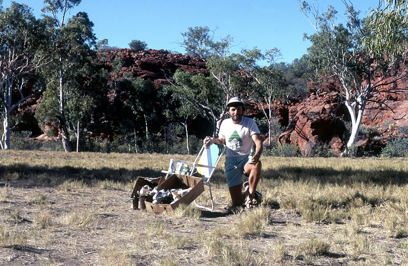
I walked on, parallel to the cliffs and then beside the road I found a chair, possibly fallen off a passing truck. I was happy with my find, because mine had broken only a couple of days earlier. My spirits were high which made me sing. My feet were also feeling better. The track was much softer and I had left most of the corrugations behind which helped the pain underfoot to subside. However, I had some blisters developing on my heels so I had to be careful not to let them get any worse.
I met another convoy from Geraldton, Mike sold them a magazine and one guy donated $20.00. They were an excitable group. I caught up with Tim and John about 3.15pm at a turn off into Killagurra Springs. We drove in and checked the scene but the camp site wasn’t up to scratch so we decided to go to Durba Springs. As we moved through a narrow gap between the cliffs of Durba Springs, we came across a grassed camp site surrounded by beautiful towering red cliffs and dotted with river red gums and date palms. It was a fantastic campsite. It was hard to believe that we were out in the desert. We took photos of the chair that I had found and about 50 beer cans and rubbish that I had collected that day. (The photo was later published in Australian Geographic’s Canning Stock Route book.) After I had washed my hair from the springs it felt soft and bouncy, just like the shampoo ads on the TV. I sat back and wrote another letter.
I picked up beer cans and rubbish along the way.
Dear Adrian and gang.
Well it’s now Sat 14th July and I have completed 500 km. I’m walking on sand a lot more which has less corrugations so my feet are getting better, except for one blister that is forming. So I’m about a third of the way and will be at our fuel drop in 5 days. We are now encountering a lot more sand dunes which I like but it is hard on my heavily laden vehicle. Being a diesel and only having four gears and little power doesn’t help. Each sand dune I climb is different and therefore very interesting……….
I’ve sold 25 mags on the stock route so far. Bye for now. Terry.
July 15th. Sunday. Durba Springs.
To rise in the morning in such a beautiful, isolated place and have no place to go felt pretty good. I rang Jenny on the radio and got the latest news; however she didn’t have much to tell. Trying to create conversation on the radio network with everybody for thousands of miles around listening was fairly daunting.
Mike left us at 9.30am to motor to Newman and civilisation. He wanted to pick up more supplies and fuel as he hadn’t arranged to have any dropped off at the Newman track. I took time to do my washing. It was the first time for several weeks that I was able to do a good job, because most evenings I washed my underpants and socks in a very small amount of water that I had already used to wash myself in. I erected a washing line between two white river gums. Termites had built a two foot high mound beside one of the gums. The nest crept up the trunk and no doubt in years to come the tree will be eaten away. I also tidied up my gear and at lunch time cooked a fresh batch of damper.
Twelve more cars arrived, bringing the number to sixteen including ours. The school holidays had turned this once lonely track into a busy highway. Three more cars called in, filled their water containers and took off again. Tim quizzed every motorist along our route since leaving Perth. He would try to find out if the people were remotely related to him. And to our surprise many of them were, or had some connection with him or his family. Tim’s enquires gave him a lot of enjoyment.
In the late afternoon we decided to explore the gorge. We passed the waterhole that travellers used only for drinking while another water hole was used for swimming. Not far up the gorge, we checked out the Aboriginal paintings. We then climbed the dry waterfall and followed the gorge, scrambling over rocks, rock ledges and around pools. The red gorge was littered with huge boulders and white river gums, many with leaning bows and green foliage that contrasted against the red cliffs. Eventually, as the sun cast long shadows we decided to return to camp via the cliff top.

July 16th. Durba Springs.
After our radio sked we were ready to move. John turned the key but the engine just churned and then died. The battery was flat, probably because we had the fridge turned on all day. Luckily we had a spare. With the engine revving, we moved slowly away from the campsite, bumped over the creek and headed towards Killagurra Spring. Here we met a school teacher from Townsville and walked up the gorge with him. We thought it strange that he was travelling alone but he didn’t seem to care.
The stunning gorge was covered with Aboriginal paintings, with crystal clear pools of water below it. We walked along the gorge for some time before heading back to the vehicle. At the parking area, previous travellers had left a fireplace that resembled a rubbish tip. It was so annoying.
I was soon dropped off at the junction of the main Canning track, where I had stopped walking a day previously. At the first real sand dune after Durba Springs, John had to let the tyres down. I walked on passing the crew and an abandoned trailer. Although the sand dunes were not huge, the boys had a difficult time driving in the soft sand. I could hear the revving of the engine and the grating of gears from several hundred metres away.
I had 30 minutes for lunch. Feeling good, I decided to run to Well 18 turn off, 10 kms ahead. I wanted to make up some distance because I’d had a late start. We visited the Well and found a water trough and a caved-in hole.
Along the track, a squashed dead snake lay in the vehicle tracks. Ants were having a feast. I walked into an area, blackened by a huge fire. The country was arid and sparse, trees were blackened and the spinifex tufts were black stumps. Burnt cans and drums were now visible away from the track. There were now more to pick up as they were no longer hidden.
The sand dunes were now higher and were testing the vehicle even more than before. I often saw the vehicle in the distance just reaching the top of a ridge but getting bogged right on the crest. The vehicle would then reverse down the dune and then rev and have another run up, sometimes failing for the second time.
The featureless surroundings made me continually think about Jenny’s last call. She said she wasn’t feeling too good but she wouldn’t go into the details. I started thinking more about the conversation and how odd it was. What sought of illness did she have?
When I caught up with the boys at the evening camp, they were parked in the middle of sparse countryside about 200 metres before a high sand dune. I had completed 40 kilometres and seen no vehicles. If it wasn’t for the nearby sand dune, the land would have been totally flat and featureless. As the light faded, emus walked around the camp. How did they survive way out here in the middle of nowhere? Their shadows were long as the sun set in the west, which created one of the most beautiful and streaky skies that I had ever witnessed.
July 17th. Near Well 18.
Eddie was able to contact us this morning but he was having problems communicating with the convoys ahead of us. We were informed that Mike and Henny had reached Newman ten minutes before our sked. I climbed the first sand ridge just north of our camp and from the top I looked down on our camp. The white vehicle stood out like a beacon. The five metre aerial was still erected on the front bullbar sparkling on the eastern side as the sun rose above the horizon. With the absence of the spinifex, the country as far as the eye could see was truly like a desolate and harsh desert.
From the top of the ridge I paused again looking beyond the vehicle to the far horizon. I could see Durba Hills. They looked so far away. I glanced over to the north east and focused on a huge salt lake. I couldn’t be mistaken – it was Lake Disappointment for sure! The large expanse of white salt was like a magnet; I wanted to reach it.
I walked along the top of the burnt-out sand ridge instead of descending onto the track. It was easier walking but hilly. I was fascinated with the large number of insect, animal and lizard tracks that criss-crossed my path. I followed some but many disappeared underground without a trace. Others stopped beneath burnt-out spinifex tufts. I hadn’t noticed so many tracks before.

My curiosity waned, so I left the ridge and joined the track which at first headed towards the lake but then away from it. Finally I left the burnt-out area and zig-zagged around sand ridges and salt pans. Just before Well 19, I crossed the Tropic of Capricorn. Beside the Well there were spoked wheels from a wagon that George Williams of Wiluna had driven along the stock route in 1938. He only made it to Well 19 before abandoning the attempt. I found it difficult to imagine that old carts with spoked wheels had actually used the track. Well 19 was silted up and polluted and could barely be seen for beer cans thrown at the bottom. People had used it as a rubbish tip. John climbed down and retrieved them. Most were fresh SA and Vic bitter cans thrown in by the people who had recently passed us. We left the Well, the wheels and some blue wrens and ventured off, wondering when or where we would find more rubbish.
By lunch time I had covered 25 kms. I then ran several kilometres to gain some ground. There were a few soft and tricky ridges with very loose sand which made running difficult. Several vehicles in three convoys that were at Durba Springs passed me by. One of the passengers from the car with a broken spring gave me an orange. Later I found an old paving brick, and a shock absorber. As I ran towards Savory Creek three more cars from Durba Springs caught up. “You’re making good time”, one guy said as he passed.
Tim and John were waiting at the creek, which allowed me to take photos of the vehicle crossing the crusty soft surface. We followed the creek, which now contained water, to the lake and found a small camping area on the edge of Lake Disappointment where we stayed the night.
The lake was just salt, salt for kilometres. Tim went for a short walk across it and found a grass hopper encrusted in salt. The wind was bitterly cold when the sun went down. I was happy to erect my tent and snuggle up inside my sleeping bag. Tom and John used their swags.

Lake Disappointment.
I sold my last Kimberley Magazine today so I was hoping that Jenny had sent some to Newman for Mike to pick up. In the last two days I had picked up 63 beer cans.
July 18th. Lake Disappointment.
There was a cool breeze from the south east. The boys had been chilly in their swag, but I was fine in the tent. After the radio sked I left the lake and walked on the crystallised creek near the turn-off where three vehicles had camped for the night. Crossing salt flats and small sand ridges, I kept getting glimpses of the lake as I walked. At the turn off to Well 20, 14 kms from Savory Creek, there was a fine stand of desert oaks which gave some great shade. About 5 kilometres further, just after the sign FX9, I had my last view of the lake. I paused for a while, looked across its great expanse wondering what it would be like to walk right across it. If there had been time, maybe I would have done it. Instead I cut the corner and walked across a narrow arm of the lake. My shoes creaked as the crusty salt particles crushed beneath them.

I looked back to get my last glimpses of the lake and then moved across a couple of sand ridges before hitting a flat track again. I felt a little sad as I walked away from one of Australia’s great salt lakes. I should have explored it further, but I had to set limits. This was an adventure of great magnitude, 24,000kms around Australia but for some reason I always wanted to do more.
About 7 kms from the lake, three more cars passed and a woman gave Tim and myself an orange each. We still had our own oranges from Wiluna, bought on the 30th June. They had lasted a long time, way longer than we expected. Because the boys had been keeping the vegetables wrapped in damp newspaper, they had also survived a long time.
After lunch, the boys came across three large sand ridges that were very lumpy. I could see and hear from a distance the screeching of the engine and their attempts to get up the ridge. The vehicle lurched from side to side and struggled to get traction. When I reached the ridge, I could see the reason why they were having such a hard time. There were deep holes eroded over time by other spinning wheels. I walked on and soon saw them having more problems. I became a little annoyed when they didn’t bother to fill in the holes, to even out the track and to make it easier for my vehicle to climb. All I could see was my vehicle breaking down in the middle of the Stock Route.

By the time I had reached the sand ridge, they had managed to get over and were away. I plodded on, with anger building up. I was thinking about telling them off for not filling the holes, but how could I do it, I needed them. We had discussed the important reason for levelling out the holes, which was to make it easier on my car and avoid damage, but it just looked as if they couldn’t be bothered. For most of the time I was out of sight so they may have thought what I couldn’t see wouldn’t hurt me. But I could see, and I was fuming. As I reached the sand ridge where they were having more trouble, I was about to have words with them but the car, after lunging from side to side like a horizontal yo-yo, moved across the summit ridge and was away.
Once over the ridge, the track levelled out and ran parallel to two high sand ridges. I started running in spurts as the track meandered. Beautiful white trees grew high on the reddish sand ridges. Here I met up with two guys in a Forerunner who had read about me in the Australasian Post. At that point, the track became corrugated and hard on my feet. I took a short cut across a sand ridge and disturbed a bush turkey. It took off in the direction of 4 white utes coming my way. I finally caught up with the boys but by that time I had calmed down. They made camp in a thick spinifex area which was certainly the worst camp site they had so far chosen.
Every night Tim would find a clear area and lay his swag down about 20 metres from the vehicle. Tonight was no exception but this time he was finding it difficult to find enough clear space to put it down so he spent a long time looking. He always put his swag down a long time before going to bed, so occasionally he would find a spider or a small lizard inside it at bedtime. Tonight more than any night John and I were waiting for a big scream. There was bound to be a snake creep in it one night.
Now I had only 935 kilometres to go.
July 19th. Near Well 22.
It was a cold night. I was snug, but the boys had been cold again. After a muesli breakfast, I ran the first 7 kilometres and followed the track which ran between two long sand ridges. It later zig-zagged so much I could hear the vehicle climbing sand ridges in a different direction from where the track was headed. I took a gamble and decided to take a short cut towards the noise. I ran quickly across the spinifex trying to avoid the clumps, but my sand shoes became like pincushions as the spinifex spikes penetrated the light material. I crossed two sand ridges and then caught a glimpse of my car. The short cut shaved off at least 600 metres. The country opened out with a large plain on the left and hills in the distance. 1.3 kilometres past the FX2 sign, a road cut across to the main track detouring around Well 22. I took the detour and the boys carried on to Well 22 and to check a short cut. There they found a sign saying ‘No Entry’. I walked towards the hills entering a burnt out area, before stopping at a road junction where we met up and had lunch and where beautiful hills beckoned over to our right. I had covered 35 kilometres.
I now walked on a track that had grader tyre marks. Ahead I could see a camp. It really looked more like a circus from a distance as there were big tents flapping in the wind. My world was becoming civilised! When I met up with the wide Talawara track that headed out to Newman, I found it dug up. A grader had gone through and ploughed it like a field. I turned right onto the track following the Stock Route, and away from Newman, the nearest civilisation, which was 437 kms away. The rough ploughed surface made walking a nightmare. Once again I wasn’t alone in my exploration as more vehicles passed by.

Line after line of pegs were dotted across the scrub. Mining companies had moved in, on a grand scale. The country was under siege, progress had encroached right into the desert. It was disappointing to see. No place is safe from a mining company.
The track improved further down where three graders had levelled the ploughed section into a level one. It didn’t last long however, as the track soon deteriorated into a mass of corrugations. To compensate, the countryside was beautiful with spinifex sparkling in the late afternoon light. With 7 kms to go I was getting weary. I had walked and run over several different surfaces throughout the day and it was taking its toll but my interest picked up when I noticed a herd of eight camels foraging in the bush close by. A lone camel, away from the rest was more alert and upon sighting me started to gallop, causing the others to flee as well. I had previously seen many camel tracks, although the camels had always eluded me, but now, in a busier part of the country, I found my first herd of camels.

At last, and with some joy, I reached the camp site at Well 23. I was greeted by John, Tim and a few other weary four-wheel drivers as well as 18 fresh beer cans and other rubbish that had recently been thrown on the ground near the Well, probably left by the guys from South Australia, as most of the cans were from there. To my delight, the other campers had already started digging a big pit to bury the rubbish. They too couldn’t understand why people who came out here for an outback experience left their rubbish behind. Not counting the cans at the camp I had picked up 32 cans for the day. I had walked a total of 54 kms that day which was supposed to have been my daily average but so far I had rarely reached it .
Tim was in his element. He had people to talk to, to dig deep into their past and find out if they were somehow related to him. It was uncanny how many times he found that he was either related, or connected by friends in some distant way.
July 20th. Well 23.
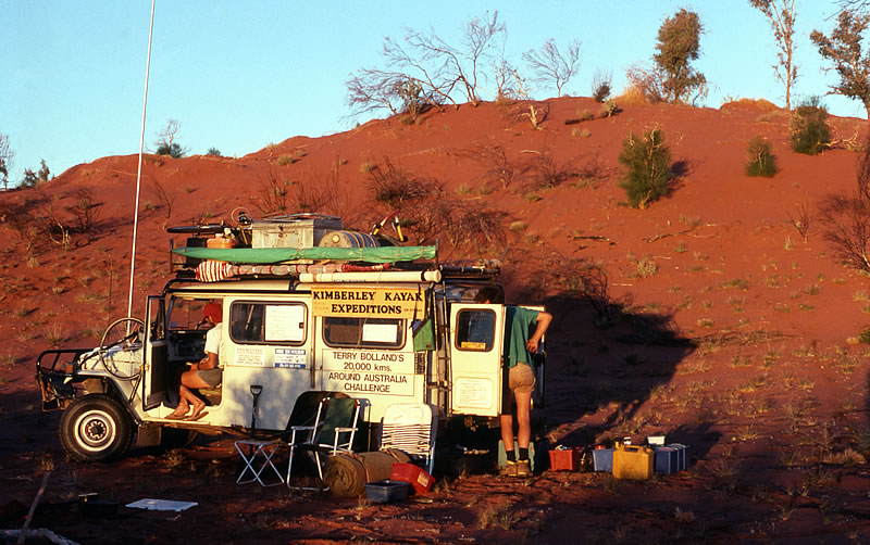
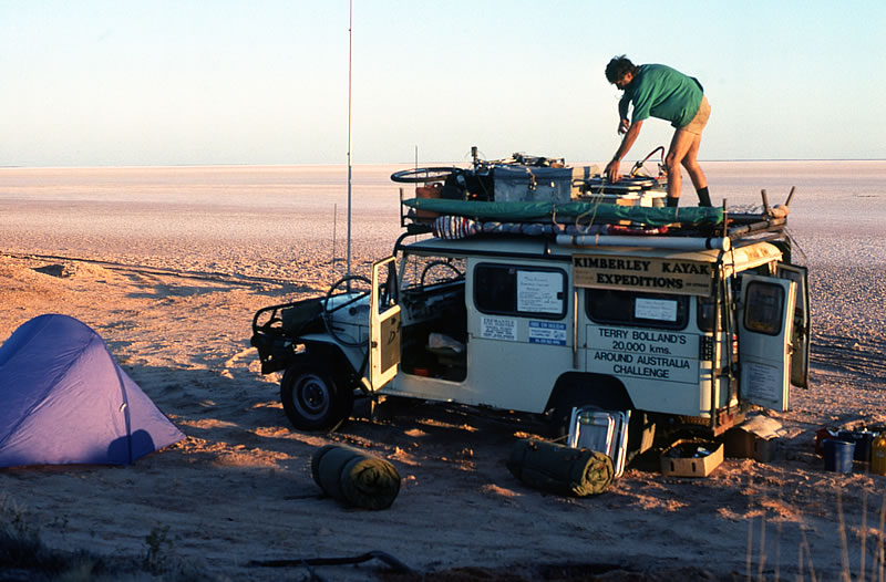
The temperature got down to 0 C in the night. Although the days were getting warmer as we had moved further north beyond the Tropic of Capricorn, the nights were still quite chilly. After breakfast we moved to the fuel dump about 1 km from our camp. Bill Shepherd from the Capricorn road house in Newman ferried 200 litre drums to the site, so travellers going right through to the end of the Stock Route could refill their tanks here. This meant that vehicles didn’t have to carry 400 litres of fuel to get them from one end of the Stock Route to the other, a distance of 1600 kilometres. At $1 a litre, it cost me $200 to get it there, which I thought was pretty good considering you can be charged $1 a litre at some outback fuel stations. There were about 70 drums lying around the fuel dump altogether, some full waiting for travellers to arrive, but many were empty. We had been warned that theft of fuel was beginning to be a problem at the drop, but we were in luck – our drum was still full.
I left the guys to fill the vehicle and our Jerry cans and I walked off in the direction of the quieter part of the stock route passing a Japanese guy studying the bush, who was stunned to see me walking by. Apparently he was doing some research work. I walked on with small, beautiful hills either side of me. My enthusiasm returned as I moved away from people and once again into the remote desert that I had yearned for. The track became very sandy, and made walking difficult. Flies pestered me and camel dung and fresh camel tracks were frequent.
Well 24 (Kurara Soak) was 500 metres off the track, close to a small hill. Although it contained water it wasn’t of good quality. The Well was an important Aboriginal meeting place and it was said that artefacts could be seen there. The sandy track continued and the hard walking soon gave me shin pain. John was walking with me at the time while Tim drove ahead to prepare lunch. We followed the track up a steep rocky hill and then descended the following ridge to find Tim waiting patiently near a small salt lake with a rocky hill over to the east. Two 4 x 4s with a trailer, caravannette and 4 or 5 kids drove in on the track from Windy Corner, which was just north of us. They were heading out to Newman.
As I moved off, a pain started developing in my right leg. I didn’t want to lose time so I had no choice but to keep battling on. I moved off the plateau onto a huge sand plain with shimmering spinifex, where I hoped the walking would be better. As the hours passed by I had lots of time to think about my life. Memories came flooding back to the time when I was 15 to 18 years old and living in England. As I walked, I thought about my friend Geoff Barnett and the good times we’d had. I wondered what he was doing now. I knew he was still a manager of a big farm, and was still married with two kids. I last saw him briefly in 1981. As I walked across the desert I was really enjoying this time of remembrance. I truly had some good times when I was young.
Finally, as the day waned I walked NW between two sand ridges to find the boys camped in a clearing not far from Well 25. We received a message from Mike that he was starting off from Newman in the morning.
July 21st. Near Well 25.
Toilet duties beckoned at 3.00am. My leg was still aching and I had thoughts of not being able to move far. However, at 7.35am, when the time came to continue, my leg felt better. I crossed several gravel flood plains before reaching the caved-in Well 25. As I moved on, I crossed a large gravel oval with not a plant to be seen. I waited a few minutes for the boys to arrive and then decided to erect my tent in the deserted bare gravel oval just to get a picture with a difference. The track continued to get better. It also afforded me a couple of short cuts. However, the spinifex piercing my shoes turned walking into hell. The sand dunes were well spaced apart but they were higher and longer and caused some difficulty for the vehicle.

I spotted Well 26 at 11.50am. There were women there lathered in soap and bathing in the trough. I was about ready to give them a few words, when, at closer inspection, I noticed the suds drained away from the newly reconditioned well, so my annoyance subsided. Tim and John were busy washing in a bucket, the way it should have been done.
Well 26 (Tiwa) was restored in 1983 by a group of Canning enthusiasts to commemorate the 75th anniversary. Although it had been newly-restored, white ants had already infested the sleepers. Instead of the party using local Desert Pines, they chose to use jarrah sleepers but unfortunately the timbers were now being threatened and would probably need replacing in the near future. The water in the Well was first class and instead of having to throw a bucket down the Well and haul it up, it had a workable winching handle and steel bucket provided. A plaque nearby commemorated Canning’s achievements.
I decided to call it a short day and take the opportunity to relax and do my washing. I took time to fix my old chair with nylon material from my swag after the chair that I had found near Durba Hills had collapsed from sun deterioration. Once our jobs were done we sat down to a tin or two of oysters and biscuits. They were mouth-watering and a real treat after spending 22 days in the desert. They were followed by custard and cake and a coffee with a big dash of Bailey’s Irish Cream to top it off. It was my favourite hot drink, my treat, and although a bottle was expensive, by being careful, it lasted us a few weeks.

July 22nd Sunday. Well 26.
Before leaving Perth, Bob Tweed had given us a huge white Coke drum which we washed out and stored our dried fruit and muesli in for the desert journey. Although it made a great storage drum, unbeknown to us it was still tainted with a coke smell when we filled it with dried food. After two weeks on the stock route, we dived into these stores to find the coke odour had impregnated all the muesli. I found the taste far from enjoyable and hard to eat my breakfast. The after-effect was even worse, for some hours later I continually belched up an awful coke taste. John and Tim said they didn’t mind the taste and continued to eat the contaminated stocks while I ate the non-polluted stuff. I was certainly very grateful.
John made a phone call to his parents in Adelaide via the Flying Doctor in Port Augustus. I called Jenny, who informed me that Henny was in the Newman hospital and wouldn’t be leaving until Monday lunch time. She didn’t know what was wrong with her.
I started walking at 9.50am and as my vehicle climbed the second big sand ridge, I took some photos. Tim had to have three goes before the vehicle made it. With the first attempt he made wheel ruts in the sand. With the second attempt, the wheel ruts enabled the vehicle to get more traction, but still stalled just before the ridge top. On the third attempt and with the right amount of speed and traction, the vehicle clawed its way across the dune. The guys never looked back and went ahead to prepare lunch on a small flood plain not far from slate hills.

After lunch, I headed towards some unnamed hills, giving me a birds-eye-view of the rock formations, caves and fallen boulders. The rocks were rich in colour, but the purple patches really stood out. I soon crossed a creek with a sign reading Canning 1907. It was erected by Ian Johnson in 1983, when he and a group found one of Canning’s original campsites.

Moving on and leaving the creek behind, I found the country was virtually bare of trees with only small growths of spinifex. I spotted two roos bounding and one small one ran across my path and towards the hills. The wildlife had been pretty scarce out here so far, so they were a pleasure to watch. I passed some small rocky rounded hills, NW of the main range of hills. After skirting a rocky range, I was back among the sand ridges and on to Well 27, which contained dirty water. From here the track became so windy that I started taking short cuts across country. Although the spinifex spikes were sharp on my feet and shins, the short cuts saved me over 3 kms that day. The further I moved north the sparser the country became with a few paperbark trees dotting the landscape. The sand dunes were also soft so the boys had to let their tyres down even further to get over them. After several more small sand ridges, I entered an area of low hills and caught up with Tim and John, who had made camp beneath a small pyramid hill. We had such a big tea that I was so bloated I could hardly move. John was now cooking chocolate rice pudding and it tasted great. Bob Tweed had slipped some chocolate flavouring into our food supplies. I just lay there looking up at the stars, wondering if I would ever get up and walk again. John used to cook so much stew, damper and rice pudding that my stomach became too swollen several nights. We saw no vehicles and I only noticed five beer cans that day.
July 23rd. Helen Range.
It had been a warmer night. Before leaving, I climbed to the summit of the small pyramid which was part of the Helen Range. Helen Hill was named by Charles Wells in 1896 and several other landmarks further along the route were also named by Charles Wells and his cousin, Lawrence Wells, who were commissioned by Albert Frederick Calvert to look for a stock route so that cattle could be driven south from the Kimberley. Some of the other landmarks named by these two cousins are; Lake George, Lake Auld, Thring Rock, King Hill and Separation Hill. Auld, Thring and King were all members of the expedition to cross the continent from the south to the Gulf of Carpentaria with John McDouall Stuart in 1861-62.

The view from the top of the pyramid was quite stunning. A series of salt lakes several kilometres long stretched north and north-west; Lake Winifred, Lake George and Lake Auld. To the south-west of these salt lakes was the largest national park in Australia – Rudall River National Park. Although I have never ventured into it, it is known to contain a spectacular arid landscape with gorges and beautiful water holes. It was named after WA Government Surveyor William Rudall who, with Hubert Trotman, searched for lost members of the Calvert Expedition (1896-97).
We were told over the radio that Mike was now leaving Newman at 12.30pm. Before moving off, I treated a blister that was just about to develop on the big toe of my right foot. Leaving the ranges and knobbly hills, I ventured back into the sand ridge country. I pondered over the many animal tracks that were about; camels, dingoes, lizards. The silence was eerie. I gazed into the far distance. There was nothing but hundreds of kilometres of the unknown, semi-featureless scrub and haze on the western horizon. Within my closer vision the track snaked across the sand ridges. A plain nearby had very little vegetation other than a carpet of spinifex which varied in height. It was still cool and a brilliant time for a stroll. It felt great to be alone, to think, to look, to walk. I always felt like telling the people in the cars that passed to leave their car in the early morning and late afternoon and walk for a while, get in tune with the bush and get away from the screech of the engine.
As I scrambled up several demanding sand dunes, small birds with a reddish tinge at the top of their tails kept me company. On top of another lonely sand ridge, the silence and my dreams were shattered when I heard my vehicle start up in the far distance. It was a reminder that I wasn’t really alone. At the top of every ridge along the route I paused and scanned the valleys between them.
I added a set of Allen keys to my collection of tools as I passed the turn off to Separation Well. Separation Well was discovered by the two Wells cousins and George Jones in 1896. Here the exploration party split up into two groups to explore the country further north and later they planned to meet up at Joanna Springs, which had incorrectly been plotted by Warburton in 1872. Neither party found Joanna Springs. Charles Wells and George Jones perished in the desert, while Lawrence Wells made it safely through to Noonkanbah near Fitzroy Crossing. Six different search parties were organised to search for Charles Wells and George Jones. Eventually, on the sixth attempt, their bodies were found at a place they now call Discovery well.
Three cars motored by me just before I reached Well 28 where we had lunch with some willy wagtails. Little remained of the caved-in well, apart from a little timber and a few drums. Later that afternoon, when I was taking a short cut across the dunes, the temperature reached 31 degrees. The short cut saved me 7kms. There was nothing at Well 29 to keep us, so we moved on a couple of kilometres to where there were plenty of trees. To our west lay the Lake Auld salt lake, and to the south east, Thring Rock.
We heard on the news that Nick Faldo had won the British Open, Greg LeMond won the Tour de France, Shelly Taylor-Smith won the women’s 42km swim in Canada, (second overall) and Wayne Gardner came second in an international bike race.
Clouds screamed over-head at a fast pace but they soon passed.
July 24th. Near Well 29.
Giant clouds racing across the sky created a beautiful but short sunrise. I started walking at 7.20am heading towards Thring Rock on a gravely surface. My mood in the morning was happy and I enjoyed every step as I closed in on Thring Rock. I knew I wouldn’t be disturbed for an hour or two, not until the guys broke camp. Below the 318 metre hill I found a small lava-hardened rock in the shape of a small human foot print with raised lava lumps indicating toes. I treasured it and started polishing it on my shorts. I thought it would be a great present for Jenny, something truly from the bush.
When the guys caught up, John walked with me for 20 kms. After lunch I walked on alone. Reaching the top of a sand ridge I paused. Below me was a new valley very different from the area I had just walked through. Termite hills rose from the valley like millions of small cathedrals. I descended into the new world, walking parallel to the sand ridges. Small trees, grevilleas, slender white gums and yellow bushes like prickly mosses closed in around me, and for some reason I felt as if I was walking slightly up hill. The soil colour changed from a red, to a discoloured pink and then a dull white, which was most certainly the soil colour of a limestone ridge. The country on my left stretched for miles without interruption of a sand ridge. I walked on, the country changing frequently. Birds were singing as I approached stands of huge bloodwood trees. I felt excited as the noise and flight of the birds around me increased dramatically. It was like walking into an oasis, a new world never discovered.

Honey-eaters scurried from tree to tree, while hawks glided in the skies above the giant bloodwood trees. What was going on, why the big change? The ground around me was covered with spinifex stands so high they looked like flocks of woolly sheep. They were fascinating to look at and a great place for small animals to take refuge. I became happier and longed for this incredible and beautiful experience to continue. I’m sure the experience could never be so dramatic or rewarding by vehicle. Being on foot was certainly the best way to see this area.
As I moved through the bloodwood trees closer to Well 30 (Dunda Jinda) I plodded through an area of fine bulldust. My shoes became smothered with fine powder but at the Well, where I caught up with the guys I was able to change my socks. The Well, not much bigger than a small depression, was dry, which was a disappointment after such a big build up.
At 2.30pm I jumped in the vehicle and we drove out to Mujingerra Cave some 4 kms away. We motored over three small sand ridges and then through a patch of high slender trees, much higher than our vehicle. The trees were thick, leaving little daylight between them. They brushed along the vehicle as we followed the thin gap of the track. Eventually we came out into a clearing and soon found the Mujingerra cave. It had a string ladder to enable us to descend the rock wall. The entrance was quite a squeeze and we had to crawl on our bellies for about 10 metres before reaching a small pool of water. A bigger pool was a little further, on the right near the end. It was very warm inside and the still water reflected the rocky walls beautifully. This looked like the end of the cave but apparently if you wade in the water and dive under the ledge at the end of the pool there is a 50 metre by 3 metre tunnel with water about armpit deep and with a roof 2 metres higher. We explored no further than the pool.
We returned to Well 30 and I started my walk at 3.30pm. Further north the vegetation changed rapidly and it wasn’t long before I was leaving the bloodwood forest and the flurry of birds. As the noise faded, the bushes became smaller and jagged limestone rock dominated the track. It was so sad leaving the hustle and bustle of the bloodwood forest area and entering desert country again. I suddenly hit a low point and felt a little tearful.
I pressed on, trying to focus on what was ahead, rather than the incredible experience that I had just gone through. I later met up with Tim and John who were talking to other travellers on the track. An Australian flag was flying from the aerial of a four-wheel drive and a British flag was flying from a small two-wheel drive Renault. At first I failed to understand what a couple of Poms from Oxfordshire were doing out here in a two-wheel drive vehicle, on a four-wheel drive track, but they then told me that they had driven it overland from England and wanted to continue their adventure. They did confess however, that their two-wheeled Renault was being towed up the sand ridges. The leader of the expedition owned trucks that serviced remote Aboriginal Communities in the area. They were saying that Eric Gard was angry because they had taken a two-wheel drive along the stock route. I could understand why, as it would really churn up the track and make it worse for others. While in Perth, the English guys had met a friend of mine in the Gosnells shopping centre car park. Bob Tweed noticed their unique car with all the stickers on and wanted to know what they were doing. Of course Bob had been proud to tell them about me and my adventures.
July 25th. Near Well 31.
We were up by 6.00am and when we made a radio sked we found out that Mike was at Well 23. The track continued to be limestone and very rough. It was slow going for the vehicle. Fresh dingo and camel tracks were evident in the dirt away from the limestone. I ran for 20 minutes or so and I had completed 10kms before the lads had caught up with me. The track then became very narrow and very sandy which meant I had to walk as if on a tight rope. It was hard work trying to balance on the narrow track and I soon started to develop lower leg pain. Just before the turn off to Well 31 the area had previously been burnt out and was now showing signs of regrowth.
We decided to drive out to Well 31 which was 4 kms south east. The Well stood among a large stand of beautiful white gums, but it had been caved in for years, nevertheless it was worth the journey. The track continued so we decided to follow it to see where it ended. Unfortunately after 3 more kilometres, during which we saw two roos, the track kept going in the far distance so we decided to quit our mission and returned to the stock route for lunch.
Two cars from Queensland stopped. Mr and Mrs Fox drove the lead vehicle and they told us that they were 94 and 90 years old and from Bowen in north Queensland. They were retired farmers and now had plenty of time to tour around. We talked for 25 minutes before heading in opposite directions.
For the next few kilometres I encountered no sand ridges as such, just small rises. I walked over a large sandy spinifex plain in the late afternoon and way over to the east I could see a rocky range illuminating in the falling sun. I finished walking at 5pm and had a huge tea, of soup and a large, large, large plate of rice and stew.
July 26th. Near Well 32.
We were camped about 8 kms from Well 32 in the middle of a spinifex plain with hills over to my right. It was cold and I left, wearing two jumpers and a beanie as I walked through a huge field of high golden spinifex in seed which swayed in the cold breeze.

I stopped walking at Well 32 where John and Tim picked me up to take me to a native well 2 kms off the track. We were a little disappointed when we found only a depression in the ground with a large bush growing out from it.
At this point, the Stock Route improved considerably which allowed vehicles to travel at high speeds. This caused severe corrugations to develop and probably the death of a black and yellow banded snake that I found on the track. Only kilometres from the Kidson Track, I could see silver reflections of what looked like corrugated water tanks over to my left.
We had lunch just before the Kidson Track crossroads. As I moved off, Mike and Henny arrived, Mike with a bad cold. They went ahead to meet me at Well 33 where we would have a cup of tea and catch up with the news. Beside the road, near Well 33, was a bore hole with a pipe only big enough to lower a small billy down. Here Mike unloaded a box full of goodies which included letters from Jenny, a bird book, a sports injury book, some boots and Hi-tec sand shoes. Mike had sold nine magazines while he was away.
We had a quick chat and I carried on reading Jenny’s letter as I walked. It was a sad letter. She had explained about how she had felt over the past weeks, coping with the knowledge that she was pregnant and I wasn’t there, and then coping with life after having a miscarriage. I gulped and held back the tears. I hadn’t known that she had been pregnant or that she had a miscarriage. It had all happened so quickly and Jenny didn’t want to discuss it over the radio. I walked on, trying to understand what she would have been going through. It was impossible to imagine. I selfishly continued walking and asking myself – was my place at home?
Thirteen kilometres after the Well, we camped in thick spinifex near a small thicket of bushes. John had forgotten the shovel at the last Well, so he drove back to find it. Mike had brought back plenty of shopping, including 20 kgs of apples, potatoes, vegies, flour, six cucumbers, tomatoes and rice. We cut up some of the apples for a delicious pudding.
Later that night I read a letter from Linda in Gracetown.
Hi Terry, I hope this finds you fit and well and of course coping with your challenges. I admire your determination and dedication to your quest in life. It was a sheer joy to meet you and have spent time together. I am impressed with your true gentleness, and although we joked about the ‘Pinto Man’, it was a revelation to me that there wasn’t even a hint of him there. That is why I found it so easy to be in your company.
I thank you for writing in my ‘Kimberley Challenge’. I was too abashed to ask. I am glad I could contribute to your journey in some way.
I thought of you on your stretch up the coast to Dongara and hoped all went well.
You both contributed to my life in such a positive way and I thank you. I hope to catch up sometime in the future but now I will attend to my pursuits while you attend to yours.
Until next time, Love Lin xxx
July 27th. Near Well 33.
It was windy in the night, so windy I was worried about our tall radio aerial being ripped off the bull bar so I crept out into the cold evening and took it down to make sure. Just before breakfast, John found a boomerang near by. Why it was there we didn’t know. It was like finding a needle in a hay stack.
It was so cold I started running at once, just to get warm. The track was heavily corrugated and difficult to run on. The scenery however wasn’t inspiring so the quicker I ran the better. The high winds also whipped up dust storms which filled my eyes with grit and dust. I passed Kidson Bluff and ran to Well 35 for an early lunch. The lunch was just amazing – bread, cucumber, tomato, cheese and last night’s left overs.
Leaving the guys with a full stomach, I headed for Bungabinni Well. The sand ridges that had many small and large desert oaks growing on them had been burnt off but the area blossomed with regrowth and was alive with budgies, flying in huge flocks. I also ran past two bush turkeys. The scenery was very pleasant because of the intermingling sand ridges and new vegetation. When we reached Bungabinni Well, John and Tim told me that they had seen two camels. The shallow native Well had been restored and a book was placed nearby to record all the travellers passing. I carried on running and made good time but John and Tim (in the vehicle) were having trouble climbing the sand ridges. I could hear the engine screaming from hundreds of metres away. By the time I reached our camp site, 4 kms from Well 36, I had run 55 kms.

July 28th. Near Well 36.
By 7.10am I was striding it out across the sand ridges to reach Well 36 where Mike and Henny had camped. I said good morning and carried on, taking short cuts across the ridges. I came to a track and followed it. I was feeling good and excited with my progress Suddenly, when I realised that I was heading east, it came to me. I was running along the wrong track. I had forgotten about a track leading to Well 37 that was out of my way and which I shouldn’t have been following. I stopped and tried to think more clearly. I had taken short cuts across country so I hadn’t seen any other track. I didn’t have the map, so to be safe I turned and ran back in the direction that I had just come. After 25 minutes, I met John and Tim ready to tell me that I was definitely heading in the wrong direction. Taking the short cut and getting carried away with my progress had now lost me 70 minutes and a lot of wasted energy. Once back on the right track I continued running again. Lunch was eaten near a rocky outcrop that contained native paintings. I carried on running and walking, taking short cuts whenever possible. The RAC map showed large U bends in the road which had the potential to be a short cut but many of them failed to be of any advantage. By now my running shoes were full of spinifex spikes which were very painful when my feet rubbed against them.
By 4.00pm I reached the Wardabunni rock hole turn off where John and Tim were waiting to drive 3 kms and check out Well 38. The rock hole was surrounded by beautiful white gums, and very tall bushes that lined 80 metres along the road. The scenery was absolutely stunning looking towards the range, especially with the sun lighting up the gum trees. We spent a short time at the rock hole, then the clouds moved in, so we returned to our campsite under the trees at the turn off (FT92). I had completed 49 kms, not counting the 9 kms that I ran by mistake. It was another windy night.

July 29th. Sunday. Near Well 38.
It was so windy in the night that I got up at 3am to tie things down. By 7.10am I was on the track and disturbing a healthy dingo that was gnawing at an old carcass. It galloped away, stopping momentarily, but frequently looking back towards me. It soon disappeared behind spinifex and bushes, leaving me with only his footprints in the sand. The track was also covered with roo and camel prints, a sign that the desert was becoming livelier. Wind whipping up from the east strengthened, flattening the spinifex and soon covering the dingo’s prints. Purple pea flowers appeared in isolated patches but increased as I moved on through the morning.
The boys caught up with me after the 12 km mark. They told me that Mike’s car wouldn’t start. Both his batteries were flat so they had to jump start it. Tim went ahead and rigged up the aerial for a radio sked and when I arrived I rang Jenny. She said she was coping and she had our friend Brenda with her at that time. After hearing the news of the baby, I was worried how she would cope. I felt a little useless being way out there in the middle of no where.
I also rang Mike Cusack who lived near Melbourne with his wife Sue and baby Liam. I met Mike and Sue in 1988 when I was canoeing around the Kimberley coast. He and Sue were living in the wilderness between Kuri Bay and the Prince Regent River. They were called the Wilderness Couple and had been sponsored by Australian Geographic. When Ewen MacGregor and I called in to see them, they were near the end of their year in the wilderness. We later became very good friends. Mike had lent us his radio for this trip. Mike was also hoping to join me on the rapid and upper section of the Murray river. Mike and his friends would raft, while I kayaked down.
I ran past some breakaway country which was a great change from the country immediately behind me. By lunch time I had reached FT88 and met a convoy of cars. They were from the VIC/NSW Toyota Landcruiser Club. They stopped for a while, exchanged stories and I sold six magazines.

As I moved on towards Well 39, the country became greener and there were more trees and birds, plentiful purple pea flowers and wattles. I had a brief stop at the Well before negotiating a few more sand ridges and then Lake Tobin. There was no salt on the surface of the lake, just some spinifex, samphire and a few sand ridges in the centre. Although I was a little disappointed with the lake’s appearance, it was always a pleasing experience to walk across a flat hard plain and get away from the soft sand and corrugations. I tried running but the track was so hard my legs jarred and they felt like lead. By 4.00pm I reached some burnt bush at the Well 40 turn off 2 kms past the lake. I didn’t want to walk the detour to Well 40 so to save time I jumped on the back of the vehicle and hitched a lift. The Well was lying close to a large claypan and is more famous for Michael Tobin’s grave. It was in 1907, during Canning’s survey trip, that Michael Tobin and an unknown Aborigine killed each other. Tobin, who was speared, shot the Aborigine and they both died. We found the grave 250 metres from the Well.

Returning to the track junction, I ran on for another 4.2 kms, making it 60 kms for the day. We camped near FT 84. We had camped on a fire regrowth. The blackened bushes had small shoots sprouting.
July 30th. Near Well 40 Turn Off.
I alternated from walking to running throughout the morning. The corrugated track contributed to the pain that had developed in my lower leg. I finally stopped running to relieve the pain a little. The boys passed me soon after I had completed 12.8 kms and drove straight to Well 41 (Tiru). By the time I had reached it, Tim was doing my washing in a bucket. I finished off rinsing my clothes and then washed my hair in the bucket. The water was of excellent quality, very soft and my hair was soon lightened and brightened up from my shampoo. I left, leaving the guys to fill up the water containers. We heard from other travellers that there was supposed to be a dingo near the Well but it was nowhere to been seen.
After walking on for 4 kms to the lunch spot, Tim served fruit, salad and left overs from last night’s meal. I soon left and cut across country but didn’t gain much ground. After another short water stop, we found the sand ridges, vegetation, birds and flowers increased. A pain soon developed in my right leg. I really needed to stop at the 45 km mark but Mike and Henny had moved on to the 50 km mark and because they wanted to use our radio, I had to keep going to their camp.
About 3 kms from camp I noticed a dingo behind. I stopped and looked and the dingo stopped. I walked on and the dingo followed. It moved from one side of the track to the other and then trotted off into the spinifex. I stopped again and it stood still. This went on for some time. I started using a kind of whistle to keep it following. I didn’t want it to leave me. I felt attached to it and astonished that it had become so friendly. At one stage it came within 2 metres of me but I couldn’t entice it closer.
The sand ridges between Well 41 and Well 42 were the highest on route. One had been measured at 16.8m. I stopped and went to the toilet on top of one. The dingo kept its distance and was quite wary of me. I moved on and it still followed. About 600 metres from camp, Tim came wandering down the track to meet me. The dingo held back and hid behind spinifex clumps, not sure why another intruder had joined me. We both walked on and I constantly called out, trying to persuade the dingo to follow. As we moved over the last sand ridge before the camp, the dingo was out of sight. My new friend had deserted me.
Our two vehicles were parked across the sand dune. Mike and Henny were parked several metres away from our camp for more privacy. John had already started on tea and had all our gear spread out among the spinifex. I took a seat facing the sand ridge and rested for a few moments before taking off my sand shoes. I watched the ridge top for the dingo to appear. For several minutes it didn’t look good. But soon after, its ears, then its head emerged above the sand dune. We gave it the name ‘Canning’.
We put a bowl of water a few metres from our vehicle. Canning crept closer, its body low and often crawling. It was shy, cautious and a little frightened but eventually Canning reached the bowl and started to drink. It reached out stretching its neck so severely that its body was some distance away from the bowl. It looked very thin, and we debated amongst ourselves whether we should feed it or not. Our heads told us that we shouldn’t, but our hearts decided that we should. With the food offered, Canning crept closer to our camp and became part of it, like a shy dog. We soon went about our business leaving Canning the freedom to roam.

A hungry dingo comes into camp.

Tim was so fascinated with Canning whilst cooking the rice pudding that he placed the rice and the pot in the washing up water instead of emptying the pot first. It was after 9pm before I finished washing my socks and underwear.
July 31st. Between Well 41 & 42.
It was the last day of July and I only had 385 kilometres to go. Since the halfway mark, the kilometres seemed to go faster but it might have been due to the fact that I was covering more kilometres as well. I woke up with a stiff leg and the sight of Canning who later joined us for breakfast. It just seemed extraordinary that a wild dingo could become so tame, but I suppose it may have been fed by other travellers.
By 7.30am I left camp, leaving the guys to tidy up. I constantly looked behind hoping that Canning would follow but it was nowhere to be seen. I felt rather sad, as I didn’t want our experience to cease. Some time later the team caught up, Tim vacating the passenger seat to walk with me. Not long after, but several kilometres from our camp, Canning joined us. It must have followed the vehicles. At the next 5 km mark, Tim swapped places with John. This time we tried to get photos of Canning walking only metres behind, but every time John pointed the camera, Canning fled into the spinifex. John tried and tried again to get a shot of me walking with Canning behind, but Canning fled from view on every occasion. Every so often Canning stopped for a break under a shady bush and then later trotted on to catch us up. Finally John and I managed to get photos with Canning and ourselves in the picture.

The dingo followed for several hours.
John later returned to the passenger seat when we caught up with Tim. I took short cuts over some sand ridges and Canning followed. I was feeling great, my spirits were high, and I knew I was witnessing a unique experience. Who else would have had a wild dingo follow them for kilometres?
About 1 kilometre from Well 42, the shallowest Well on route, I spotted another dingo fleeing over a sand ridge to my left. I walked on but my heart sank when Canning fled. I had lost a friend and was alone once more. I searched for it, but my unique experience had now come to an end. The sight of another dingo may have unsettled Canning and it may have decided not to enter the territory of another dingo. At this point he was far from home. I wished Canning the best of luck, and continued my journey north.
Well 42 close to the Guli Lake was only an old water tank. It resembled an unearthed graveyard. A pitiful sight of a camel’s carcass lay reeking only metres from the disused Well. Other smaller carcasses lay like rugs adding to the morbid scene. Rubbish left by other travellers, who took it on themselves to create a rubbish tip, left us in no doubt that we should move well away from it for lunch. It was probably the worst well we had seen so far. The only inspiring thing about the Well were the hundreds of finches that flocked around the Well to obtain the last pools of water.
We sat on the edge of Guli Lake, chatting, thinking about Canning and eating the most remarkable meal of delicious green salad, fruit salad and left-overs from the previous night. Despite being in the middle of nowhere I had eaten some most delicious meals, mostly stews. Most were made from the same ingredients over and over again but the lack of junk food and variety of foods made me very appreciative of the food that was prepared.
The walking surface across Guli Lake was perfect – much easier than walking in a very narrow sand track that was barely wide enough to place one foot in front of the other. Leaving the lake, we found that the sand ridges and spinifex returned. I tried walking between the tracks on the spinifex hump but it was too uneven and more difficult to walk on. By the Well 43 turn off, my left leg was hurting again. I moved on another 6 kms before finding our camp on a seismic line, but by that time my leg had worsened. Henny cooked a great damper.
August 1st. Near Well 43 Turn Off.
My leg had stiffened in the night. Mike and John made a radio call. We were now going through the Flying Doctor Base at Derby. John called Linda in Karratha. It seemed that they were still fond of each other. I left them to talk privately and started walking with a stiff leg. There was a cool wind blowing which was getting more unusual every day I moved north into the tropics. By lunch I had walked 20 kms and apart from passing the Well 44 turn off, and finding several drums containing aviation fuel, the 39 km day passed with little activity to speak of. We had experienced three days without seeing a vehicle and I was pleased that we could still travel a few days in the wilderness without seeing someone every day. The school holidays had made a big increase in traffic on the first section of the stock route. Some of the wells were now off the main track, with up to 20 kms to detour so many of these I missed.
August 2nd. South of Gravity Lake.
It was hard to believe it had been zero degrees in the night. My legs were showing a remarkable improvement with no stiffness or aches. After so much time walking in my sand shoes, I started wearing boots and gaiters to prevent the stinging spinifex spikes prodding my feet and shins. Later down the track I changed back to my sand shoes as the boots and gaiters were not as comfortable.
I was now in the heart of the Great Sandy Desert. It was named by Colonel Warburton in 1873. However, it was originally named the Great Australian Desert by Augustus Gregory in 1856, who thought it continued south-east to Sturt’s Stony Desert. It is 258,000 sq km. Most of the dunes generally run east-west, where-as many of the dunes further south run south-easterly.
I spotted cars in the distance driving on Gravity Lake. Interested in seeing it, but not wanting to walk to it, I hitched a lift with the boys when I reached the lake turn off. It wasn’t a brilliant sight, certainly not worth writing home to Mum about. We noted that the cars had stopped near a hill. We followed and found the occupants looking at some Aboriginal paintings.
Back on track, the sand ridges had now eased. We met up with two vehicles, and sold the drivers five magazines. What a bonus! At ten dollars a time, they helped pay for some fuel.
John had broken the CB antenna so they couldn’t talk to Mike in the other vehicle. Mike’s vehicle was also playing up, owing to fuel problems, although it wasn’t until later that he told us that he was just about out of fuel.
I walked the final part of the day over wavy sand ridges, many burnt from a recent fire. I found a good hacksaw. By the time I stopped I had completed 50 kms, camping approximately 4 kms south of FT60 near Mt Ford.
On the evening news bulletin we heard that Iraq had invaded Kuwait. It didn’t mean too much to us at the time, but as the days went by we started to realise the consequences.
August 3rd. Near Mt Ford.
The temperature gauge showed zero yet again. Who said the desert was always a hot place? I walked off full of thought, towards Mt Ford. Even the slightest hill is beautiful in this mostly flat and sparse area, especially in the early morning and late afternoon when the sun light reflects deeply on the rock. On closer inspection, a large cairn and marker erected on the summit, spoiled the beauty of the tiny mountain. When the boys caught up, I climbed a small hill overlooking the range. In the far distance a camel was crossing a flat gravel plain. I looked north knowing that my time on the stock route would soon end and another adventure begin. For a moment I felt sad, I was really enjoying my walk.
Wasting no time, I descended the hill and moved on, walking for the next 3 hours with my left foot aching. By lunch time I had completed 25 kms, crossed several small sand ridges and my foot was throbbing badly. I tried to subdue the pain by having a massage. Tim never objected to the time he spent massaging me. At 3.00pm we rigged up the aerial and phoned Jackie at the ABC. She wanted to know my progress. I continued my walk for another 8 kms towards Mt Romilly where I found a tyre lever.
That night we finished off our meal with freshly-made nut bread and jam.
August 4th. Near Mt Romilly.
At 6.50am as I left camp a falcon circled overhead. The warmer morning encouraged me to move earlier. Five kilometres up the track I passed Mike and Henny who had run out of petrol and were using their last dregs of gas. The boys caught up and exchanged water containers for fuel drums with Mike. If Mike was going to get out of the desert, John and Tim had no choice but to drive 300 kms out to Carranya Station to get him some fuel. I was pretty annoyed. He had always insisted that he was an experienced four-wheel driver and throughout the stock route his car had been running badly and now he was out of petrol. It also meant that my vehicle had to travel an extra 600 kilometres over very rough tracks.

Moving on, I checked out a small old caravan that was abandoned on the side of the track. It still had some cans and magazines inside. It looked as if it had been involved in an accident and dragged off the track. Towing such a caravan would have taken a big-powered vehicle to get it over the dunes.
Mike was now my back-up, stopping every 5 kms or so to give me water. He had little fuel left so we didn’t know where his truck would stop. At lunch time we stopped to eat under a cliff face of Breadon Hills. I really wanted to go into the hills and check out a water hole that was believed to be a beauty, but it was too far to divert by foot and Mike didn’t have enough petrol to take me.
I moved on across a fairly flat plain with the impressive Breadon Hills beside me. It was hot, dusty and the dry vegetation increased my thirst and blocked my nostrils. There was no wind and, as I walked, I felt the harsh dry environment. The hills, with steep cliff summits, prompted me to take several self-timed photos as I walked on. Having no tripod with me I used bushes, stumps, anything that raised my camera above the ground. The hot day made me realise that the southern mild weather was now well behind. I was striding through bulldust, shin-deep spinifex and areas of the strangest flowers. It was hot and I continually waved annoying flies away from my face.
Mike had gone ahead but unbeknown to me he had run out of fuel 4 kms further on. As I got closer, I passed a bore with a steel casing. I passed a company of hills, one looking like a temple over to my left. Reaching Mike at 3.45pm, I had no option but to stop for the night and wait for the lads to return with the fuel.
John and Tim finally arrived back at 9.00pm. I was getting worried, as they had been away for over ten hours. As we exchanged stories the guys told me they had taken a wrong turn and driven for hours along the wrong track before realising it.
August 5th Sunday. North of Breadon Hills.
I left the team at 7.00am, passing termite moulds, the odd bloodwood tree and white gums. The sound of vehicles grew louder about an hour later, spoiling my solitude. As they passed they asked if I required anything before making a dash for Well 49. When I caught up with them they were busy doing their washing. Behind the Well, I noticed a grave. The plaque read Jack Smith – Died May 23rd 1939 R.I.P. Apparently Jack wanted to travel the Canning so he asked a drover, George Lanagan, to take him on as one of his team. George wasn’t too keen because Jack had received an injury after a horse had fallen on him in Onslow and still wasn’t fully recovered. However, Jack’s persistence won out, and George allowed him to join his team as a drover.
Unfortunately for Jack, he became very ill after reaching Well 45. After meeting up with two dingo poisoners who were heading back to Halls Creek, George asked them to escort Jack back. Jack never lasted the distance and died in his swag. The dingo poisoners informed the police at Halls Creek and Constable A.J. Jones, assisted by Sam Hazlett Junior, rode a 500 mile return journey to locate and bury Jack near Well 49.
The 50 foot well was reported to have some of the sweetest and most refreshing water on route. It had a very secure well lid which insured that nothing could fall into it. My hair was dusty, straggly and like leather and really need washing. Taking the bucket from Tim, I lowered it down the well. There was a knack to get the bucket to sink. Lifting the full bucket 50 feet back to the surface also took some strength. I didn’t want to waste much time so I put the bucket on the ground, placed a hand either side of it, stretched out my legs and dipped my head in. I dunked my head several times to rinse my hair. The water was so soft, my hair felt unbelievably fresh. Not bothering to wash any further I moved off, leaving the guys to hang the washing and catch up at a later hour. It has been estimated that the Well stores 4800 gallons and can supply over 500 gallons an hour.
By lunch time, the scenery was far from special. There were no sand ridges to cross as they ran parallel to the track, but the track was very very soft and sandy. When I made it to camp Mike and Henny had their wagon opened up and it looked like they had settled in. We greeted each other and I moved over to Tim and John. Minutes later as Mike stood next to the vehicle, he started to clutch his chest. Within seconds his legs seemed to go from under him and he lay on the ground shouting for his pills. Henny responded quickly and gave him some tablets. I could hardly believe what was going on. Here we were in the middle of the desert, Mike had been with us for only 9 days, on the northern half of the track and already he’d had car problems and run out of petrol and now he was having a heart attack! What the hell could we do? I had known that he suffered from a heart complaint but he said his tablets kept it under control. Henny told us that he must have forgotten to take his tablets because of the activity and problems with the car, but she insisted he would be okay once the tablets took effect.
I stood there feeling quiet helpless. Henny was very calm and had everything in hand. We put him in the shade of the vehicle, as the sun was pretty intense. I felt we must camp for the night and let him rest. However, Mike started to come around and soon he could sit up and talk. He said he wanted to go on. It seemed a crazy idea as his skin was ultra pale, his face haggard and he looked in no shape to drive. John said he would take over the driving as Henny couldn’t drive but Mike insisted that he wanted to carry on driving at a slow pace. We moved on. Henny kept a close watch on Mike but she would have had little chance of stopping the vehicle if Mike experienced another heart attack whilst driving. Apart from several bush turkeys leaving several tracks in the sand, the only visible thing that I noticed were three planes flying overhead. I must have been passing under a flight path.
I passed the turn off to Well 50 and within a couple of kms ran passed a stand of desert oak, but forged on further to the finish of the day with 52 kilometres under my belt. That day I picked up 40 beer cans, saw no cars, passed the 3000 km mark of my trip and witnessed my first angina attack.

August 6th. Near Well 50.
My 6.30am start allowed me to achieve more kilometres. I wanted to finish the track in 39 days, my exact age at that time. The country opened up as I moved away from the main desert. Spinifex still dominated the scene with scattered bushes, corkwood trees and gum trees. The very few sand ridges that were still around were now only small. I walked away in the opposite direction of the hills of Minnie Range which were to my north-west some 5 kms or so away.
I found a masked swallow exhausted on the track. I picked it up with ease and placed it off the road near a clump of small bushes. A short time later I made a left turn following a seismic line that John and Tim had told me about. By the 8 km mark, the boys had caught up. The track was wide and firm. It even looked more civilised. A grader looking for minerals had scraped it flat. A small bird flew only metres away from me and landed in a small bush where it sat watching me. It gave no indication of being frightened as I closed in and took a photograph. I left it in peace and moved on to an area dotted with termite mounds.

After lunch and a piece of nut damper, I joined up with the main track and met a couple from Yass who had a daughter at home in a coma. Whilst we were talking two more four-wheel drive vehicles from Brisbane stopped for a yarn. I managed to sell three more magazines but lost valuable time in the soaring heat. Consequently I needed to stride it out, and with the easy walking conditions and little interest scenically around me, I put on a spurt.
At 5.00pm I noticed a dust storm heading towards me. It was caused by vehicles travelling at a fast pace. The sign on one of the vehicles said ‘Taxi’, although it wasn’t the conventional type. As it came to a storming halt and the dust settled, I could see it towed a trailer full of fuel. When the driver jumped out of the vehicle he introduced himself as Peter Vernon. Coincidently, he had run the stock route several years earlier. When he’d tackled it, his party had used motorbikes and he was able to follow them and take lots of short cuts. He was now on another mission, to re-route part of the track.
It was great to have a talk with someone with similar aspirations as myself but I found myself being a little jealous because Peter had run the stock route before me. They left in the dying light in a cloud of dust. The silence captivated me. My surroundings were flat and non-descript but I knew that this was going to be the last night on the Canning Stock Route so I was excited. As the fading evening turned to darkness, my mind was full of memories of the contrasting scenery of the last 38 days. The evening was perfect and beautiful for walking and for remembering. The moon cast a shaft of light in front of me and I followed it. There was enough light for me to see and walk into camp situated in the middle of a plain.
August 7th. Near Overflow/Sturt Creek.
I was up at 4.15am, had breakfast and away by 4.45am. The bright moon gave me enough light to see and walk, but an unevenness of the track often caused me to trip. As the sun rose, the moon virtually disappeared, leaving only a faint outline. John and Tim passed at 7.15am after I had completed about 13 kms. They had damper and jam ready for me at the 20 km mark and a mixture of vegetables at the 25 km mark. A few kilometres later, I passed a heap of feathers plucked from a bush turkey, – someone else’s meal.
A truck and ute driven by Aborigines flew by, blowing their horn and forcing me to jump aside. I turned to follow their progress and noticed a swag being trailed behind. The women on the back hadn’t noticed it.
The rubbish increased significantly at Bloodwood Bore. The heat also brought the flies. It was certainly disappointing and disheartening to see so much rubbish and I now found it difficult to appreciate the country.
Along the track I met up with spider man, Harry DeJong. He had been wandering around the area for years collecting spiders for the museum. He took a box from his vehicle and showed me his collection. I was fascinated and absorbed with his stories and the patience that he had to catch them. I was later told that he collected them for the museum for nothing.
Leaving Harry to continue his journey, I was informed by John and Tim that he had nearly run them off the road. My next visitor was a man in a landrover. He had placed food drops for a guy cycling from Alice Springs to Newman over the central inland route. He was cycling 30 kms a day. I thought it would be quicker to walk.
I thought I would be rejoicing at the completion of the Canning Stock Route, but as I neared the end I found myself pensively reflecting. I was leaving a commercial-free area where the clock has little relevance and crime is non existent. Tomorrow I would cover new territory.
I left only footprints, thousands of them and picked up 750 discarded beer cans. I felt good as the track was a little cleaner now.
When Billiluna was in sight, I quickened my pace. These were the first sheds and houses that I had seen for 1600 kms. I walked on, edging around the compound and passing a vehicle rubbish tip. A few minutes later, with a hurting shin, and 60 km for the day under my belt, I was filmed by Tim and Mike at the junction of the Canning Stock Route and the Tanami Track. My walk had come to an end. Although I was at the end of another gruelling stage of my massive journey, celebrations were far from elaborate. We toasted my success with a milo drink and ate a solitary biscuit that we had brought with us for this momentous occasion.
With nothing much more to do, other than reflect on my walk, I jumped into the vehicle and we headed towards Halls Creek to refresh our food supplies and fuel. The road was dusty, corrugated and littered with cattle. To make matters worse, apart from darkness falling, the steering on the vehicle was atrocious. The boys had told me some weeks ago that it wasn’t steering too well, but I didn’t realise how bad it was. The car had a mind of its own. Occasionally, and without any reason, the vehicle would swerve off to one side of the road. I felt more fearful for my life at this point than at any time when I was kayaking in crocodile country around the Kimberley coast. Along the way cattle roamed across the dark track at will. It was the most scary ride that I had ever experienced and I knew then what was going to get priority when we arrived in Halls Creek.
A mechanic solved the steering problem in Halls Creek, we resupplied and returned to the junction of the Canning Stock Route and the Tanami Track where I continued my big journey by cycling the Tanami Track to Alice Springs on my mountain bike.
· Mountain Bike 1350kms along the Tanami Track to Dalhousie Springs
· Walk 450kms across the Simpson Desert to Birdsville
· Cycle 2200kms from Birdsville to Cooktown
· Kayak 800kms from Cooktown to Cape York
· Cycle 5460kms from Cape York to Wilson’s Promontory including some kayaking
· Walk 900kms from Wilson’s Promontory to Mount Kosciusko
· Kayak 2500kms down the Murray River
· Cycle 1000kms from Goolwa to Melbourne
· Walk and cycle 1300kms around Tasmania
· Cycle 4300kms from Melbourne to Perth