Kimberley Kayak Expedition – 2 – 1983
54 days Solo
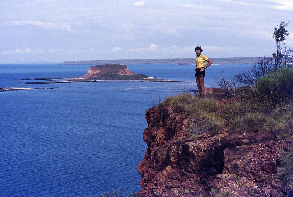
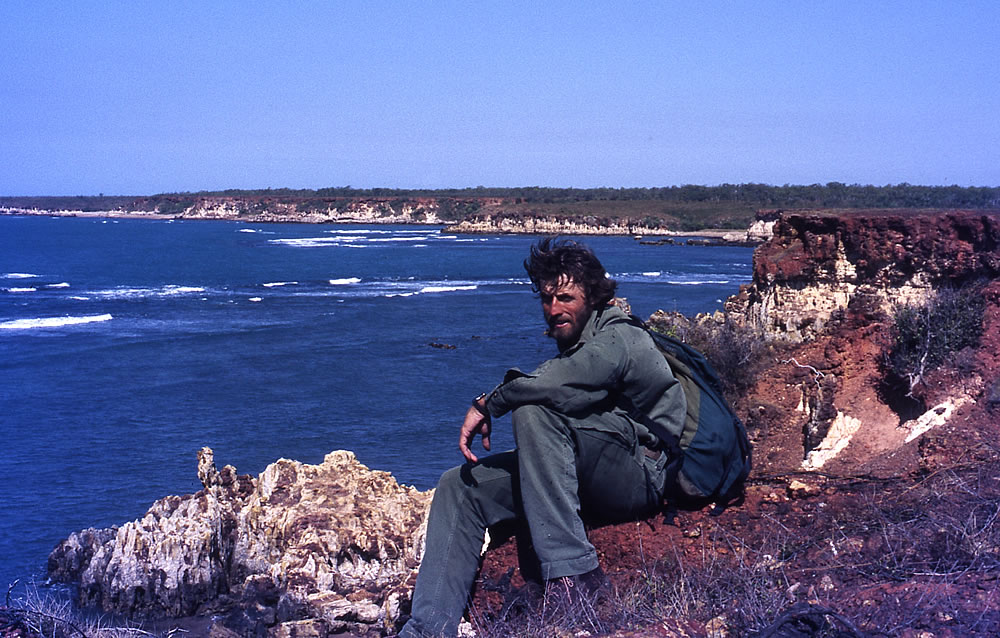
Dead coral washed up by the tide and bleached by the sun, formed a thick layer along the beach. To the north, several reefs extended for kilometres out to sea and as I climbed the steep cape the tide below rushed out at tremendous speed. Looking out into the haze I felt as if I was on the edge of the world. No matter in which direction I looked there was not a soul for hundreds of kilometres. I was alone on the edge but it was a fantastic feeling to be on my own in this great wilderness that only a few people have seen.
Ten months after my 100 day solo kayak expedition from Broome to Mitchell Plateau I was ready to complete the second stage of the journey. This was about two-thirds of the distance and involved travelling in the opposite direction from Wyndham to Mitchell Plateau, to make use of the easterly winds.
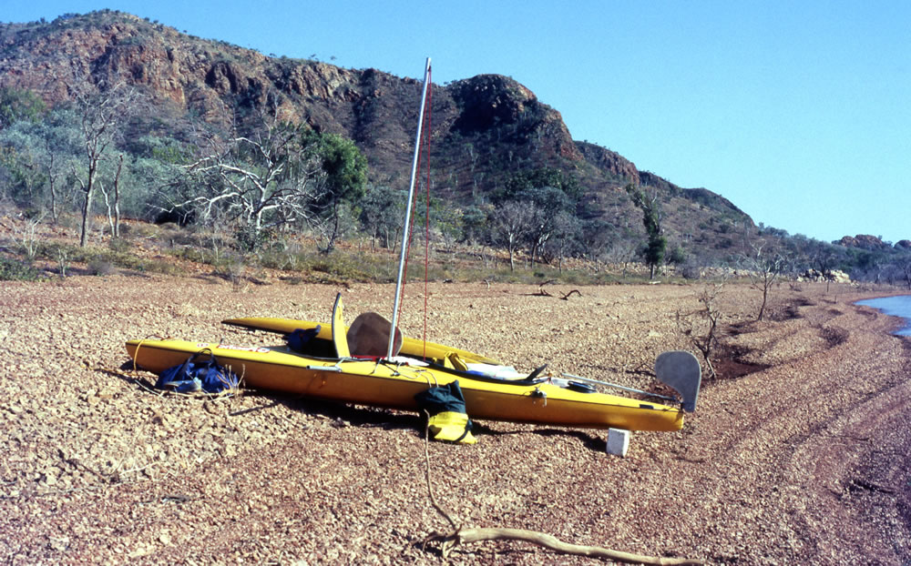
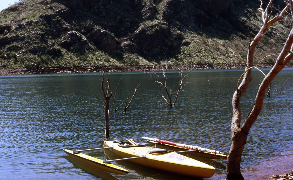
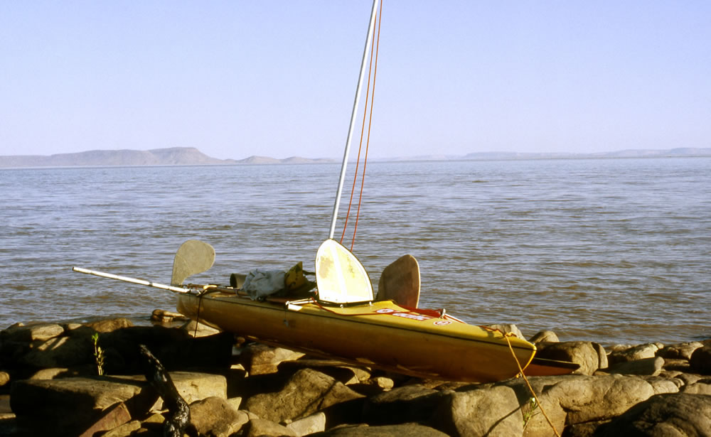
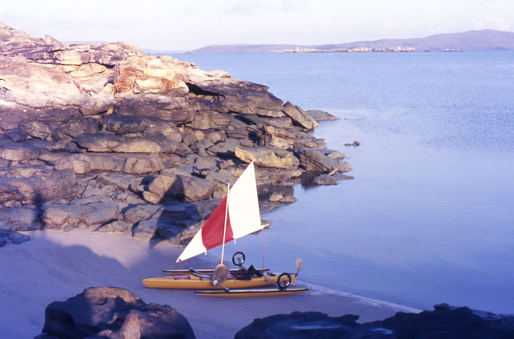
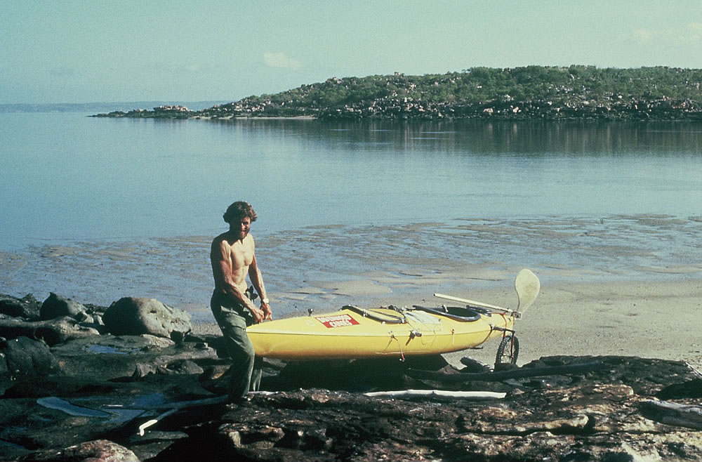
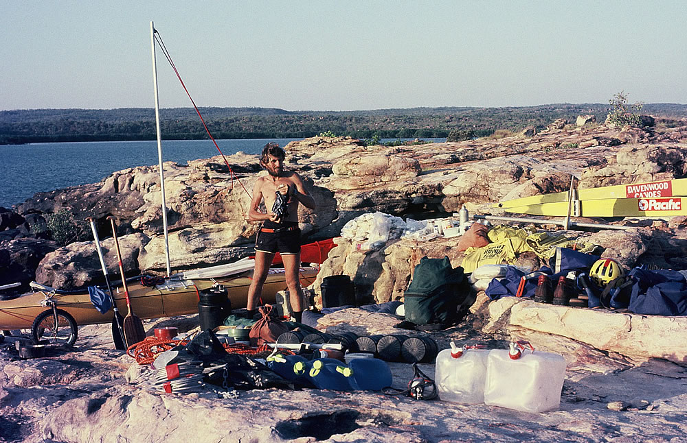
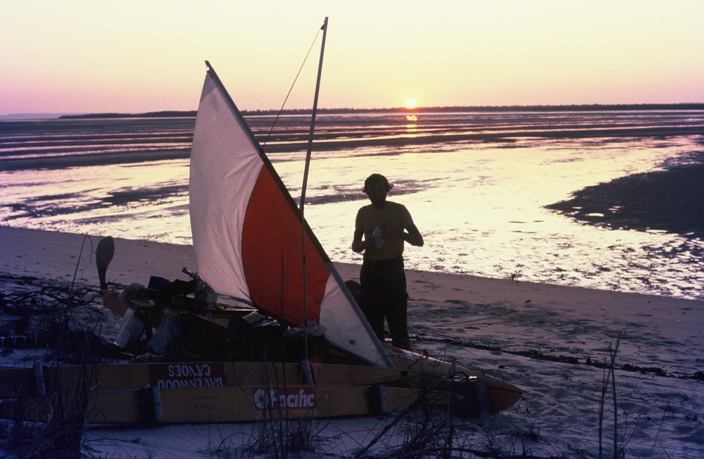
Because of the crocodiles and the shark hits experienced on my previous trip. I decided to take a different kayak which would be fitted with outriggers and a sail. The sail would help to increase the speed of the much heavier kayak that I was using.The outriggers would give me extra stability just in case of croc and shark attacks, but because of the outriggers I would have to paddle with a canoe paddle which would make paddling slower if there was no wind. Because the kayak was so heavy and I strained to lift it, I took a set of wheels which would help when I had to drag it as far as 600 metres up a beach.
My finances were still low so I had no alternative but to hitch a ride in a truck with the son of Robin Butcher, the man who gave me a lift the previous year. When we reached Karratha the old truck that we were carrying on the back of the big truck was off-loaded and a grader tractor put in its place. This meant the old truck needed a driver to get it the remaining 1826 kilometres to Fitzroy Crossing, so I drove it. The truck was pretty old, it had no power steering and a tricky gearbox that wanted to grate every time I changed gear. Once at Fitzroy Crossing and I had delivered the truck, I then had to get my kayak and gear 360kms to Kununurra so I paid for it to be taken to Kununurra on another truck. Although I was in a fairly remote part of Australia I tried my hand at hitch hiking and I managed to get a lift with an Aboriginal lawyer.
The plan was to have a 7 day canoe trip around Lake Argyle and then paddle down the Ord River to Kununurra to where a quarantine section of the river was off limits. Here I would to transport all my gear around to Wyndham. From Wyndham I would paddle out of the Cambridge Gulf out into the Timor Sea visiting such grandeur places like the Berkeley, King George, King Edward, and Mitchell Rivers, Kalumburu, Truscott abandoned airfield, Cape Londonderry, Cape Bougainville and all areas before Mitchell Plateau.
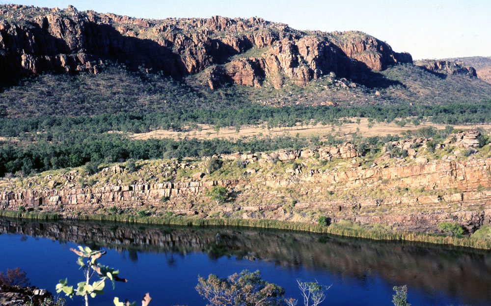
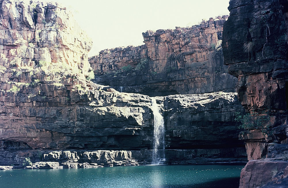
The scenery was breathtakingly beautiful on Lake Argyle with high cliffs, mountain ranges and sparkling blue water. Although the panorama was magnificent, the crystal waters glistened, the majestic red peaks probed the cloudless blue skies and kangaroos were plentiful, it lacked the tidal influences that the ocean has so I could hardly wait to start my coastal trip. The lake has a volume of water nine times that of Sydney Harbour.
Camp on Lake Argyle
Looking down from a cliff on Lake Argyle
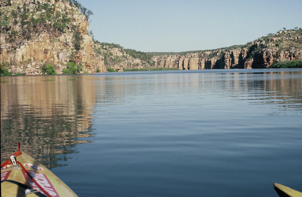
Transferring from the lake to the river was a pleasant surprise. The river meandered through gorges and plains and the bird life, animals and Johnstone crocodiles were abundant. A slight current aided my passage through narrow channels with reeds and paper-bark trees dominating the banks. Baby crocs slept on small branches, dingoes paced the plains and as the river widened the current eased , the sun beat down and the tranquil surroundings stood still. The Carlton Ranges formed a giant amphitheatre with deep shadows in their folds. As I paddled through the gorge the spectacular cliffs were reflected in the clear still water. Camped inside the gorge on top of a red rock platform was totally idyllic and although freshwater crocodiles were present the water was perfect to take swim.

Below the dam wall
The Ord River

Transferring to Wyndham and leaving the security of the lake and the river I now had to make sure I and my equipment was ready for the expedition and dangers ahead. There were many dangers and at Wyndham the locals did their best to discourage me to take on the journey with stories about man-eating crocodiles. One local thought it would be good for the tourist business if I was eaten, but I had received the same encouraging comments the previous year and had survived 100 days at sea.
After informing the police of my journey they didn’t want me to leave without taking a rifle. They weren’t trying to force me not to go but only concerned with my safety so after getting a permit I bought a .22 magnum rifle. I didn’t know if it would be powerful enough to stop a crocodile though.
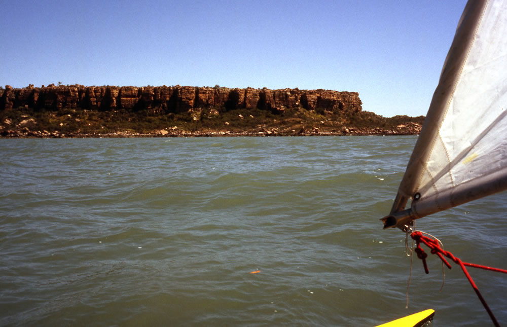
As I loaded my kayak to leave from the boat ramp, not far from the meatworks, a croc watched my movements from the muddy waters of Wyndham. With sailed hoisted, I passed the famous Wyndham meatworks where dozens of crocs congregated around the meatworks spillway. Immediately ahead were 20 kilometres of mangroves, which were thickly lined on both sides of the massive Cambridge Gulf and made landing impossible.
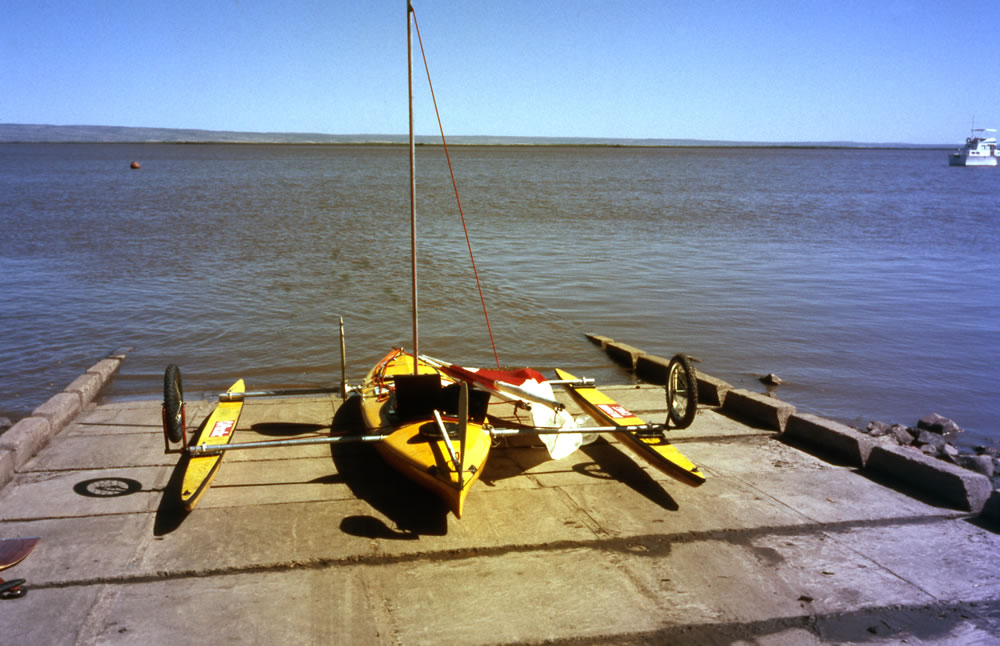
Leaving Wyndham with numerous crocodiles around the meat works

Leaving Wyndham
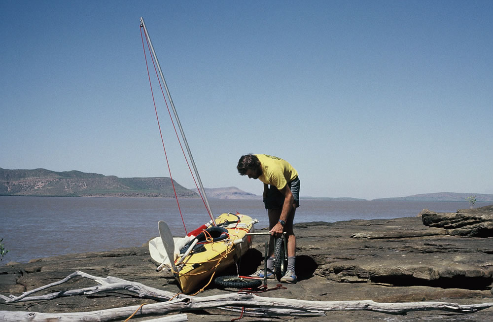
Camped on island in the Cambridge Gulf
Landing on rocks
It took three days to paddle-sail out of the Cambridge Gulf. Landing to camp was hampered by mangroves and rocky shoreline. It was on the rocks that I chose to land, but it was a continual strain watching for crocs to creep up from the muddy waters. I eventually left the Cambridge Gulf and paddled into bluer ocean waters finding a sandy beach to land on. It was certainly more relaxing being out of the gulf but the dangers were still present as a four metre crocodile patrolled the beach in front of my camp. Experience on the previous expedition reminded me that they appear in the least-expected places.
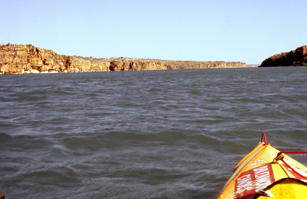
About to leave the Cambridge Gulf
I clicked a few photographs, it had a massive hefty body and a jagged tail that looked like a giant saw as it moved slowly backwards and forwards along the surf line. As the light faded the crocs silhouette appeared between the waves. I kept the fire blazing and strung my hammock as high in the trees hoping for a good nights sleep.
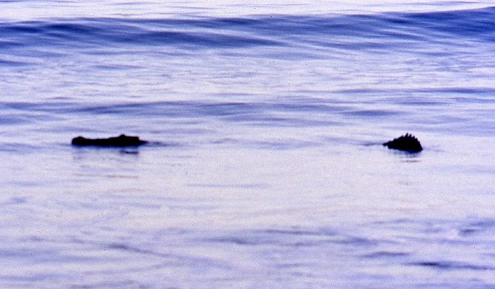
A croc patrols my beach campsite
The next morning the croc was nowhere to be seen, so aided by strong easterly winds, I paddled-sailed along the coast to my first destination, the Berkeley River. Leaving some of my stores at the mouth of the river, I paddled ten kilometres upstream, passing cliffs and mangroves, to arrive at a dry waterfall at the head of Casuarina Creek. The mangroves and steep cliffs provided no suitable camping spot but a coffin size ledge on the dry waterfall was just big enough and it was a metre higher than the high water level. A lower ledge that was 2 metres above the existing water level enabled me to drag the heavy kayak onto the ledge before moving it to the higher one.
Heading up the Berkeley River towards Casuarina Creek and Falls
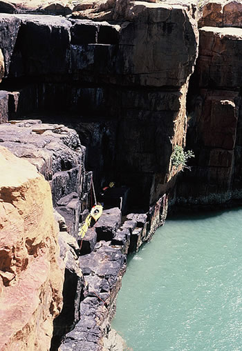
My camp for the night was on the ledge of Casuarina Falls
As the tide rose that evening, completely covering the lower ledge, I became a little worried when my torch beam illuminated red eyes of crocodiles staring towards me. The water wasn’t much more than a metre below my bed and hundreds of flying foxes circled above the amphitheatre of cliffs, so I had a disturbed night’s sleep.
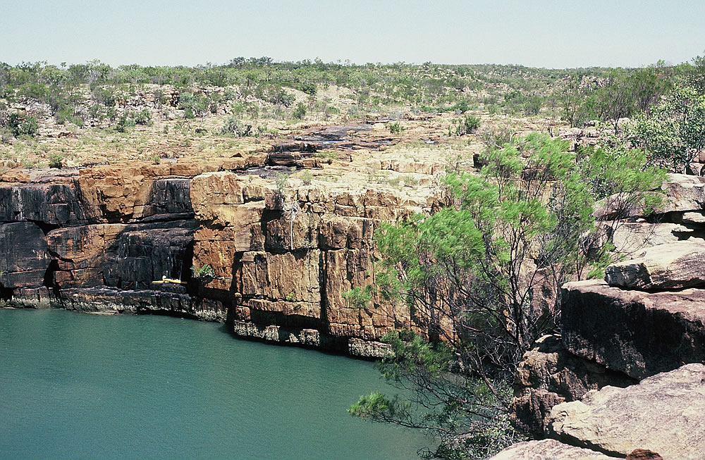
My camp on the ledge of Casuarina Falls
To reach the billabong above and to explore the area around Mt Casuarina, I had to scale the sheer walls of the waterfall which was a risk worth taking. Exploring the hinterland was another exciting part of my journey giving me different insights of the remote country.
After stocking up with fresh water from Casuarina Creek, I headed further upstream with the tide. Massive vertical cliffs lined the river and crocs mingled with the mangroves. When the tide turned I left this picturesque place and headed once more out to the coast. With strong winds behind me, I made excellent time heading towards King George River.
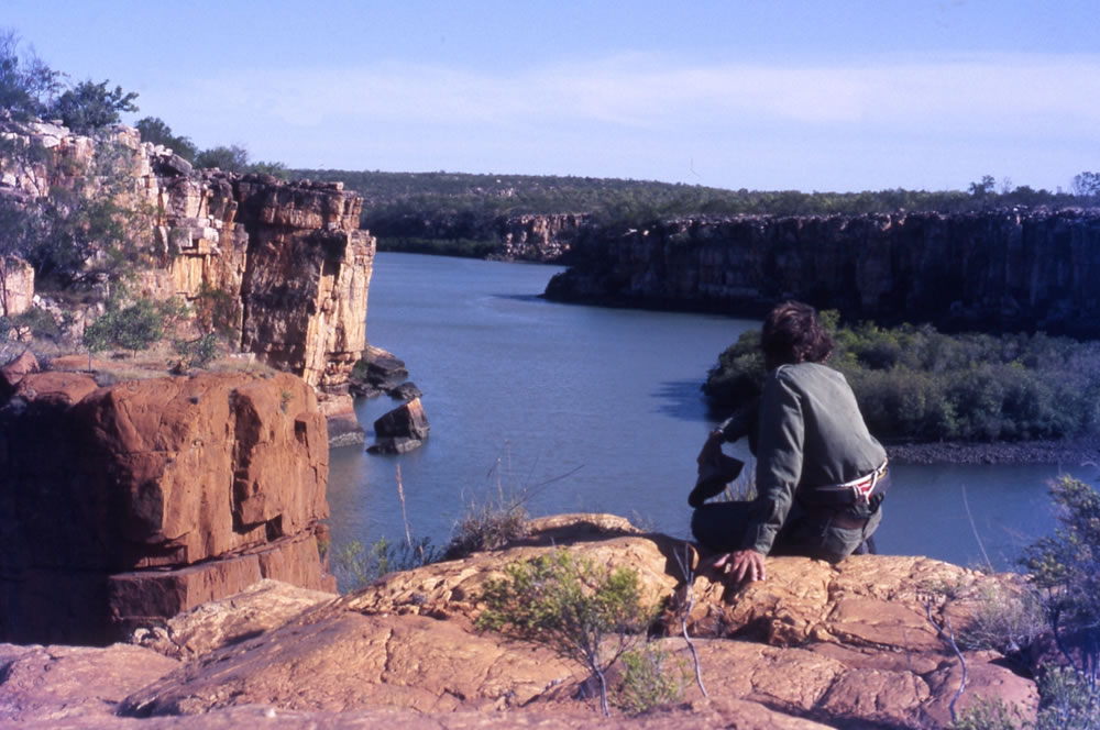
Looking down the Berkley River from the top of Casuarina Falls

Cliffs of the Berkeley River
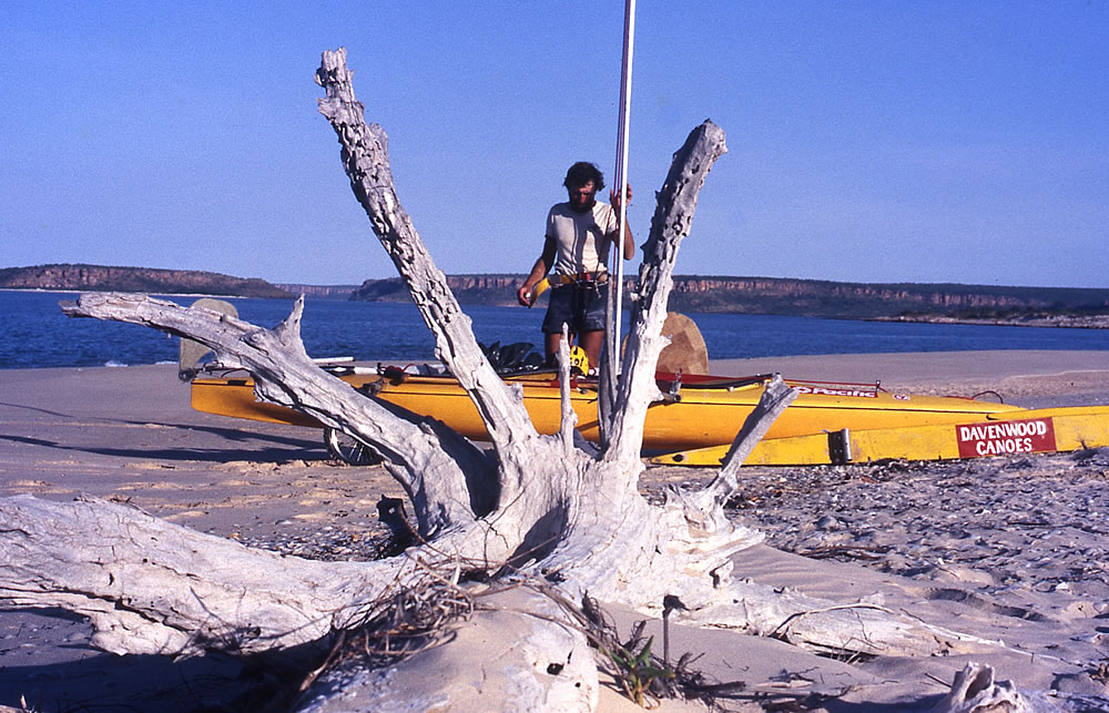
Camped near the mouth of the Berkeley River

It was along this section of coast, on a storm tossed night in 1932, that two German aviators, Hans Bertram and Adolf Klausmann were forced to land their seaplane, ‘Atlantis’ after running out of fuel.
From Bertram’s book…
“We have wandered for seven days without food and water. We have outswum crocodiles and outwitted mosquitoes. We have left hopefully and returned naked and lacerated. Here, however, we feel at home again. Our plane is a small cocoon, protecting us from the unfriendly world outside. Yet again we consider our problems and strategies for escape”.
Soon after, they decided to convert the plane’s float into a sail-boat and they paddled west at the mercy of the wind and tidal currents to Cape Bernier. Here they found themselves exhausted and at the brink of madness and death they took refuge in a cave and were eventually rescued by an Aboriginal search party, ending their 53 day ordeal. (Five years later I retraced Bertram and Klausmann’ incredible survival ordeal.)
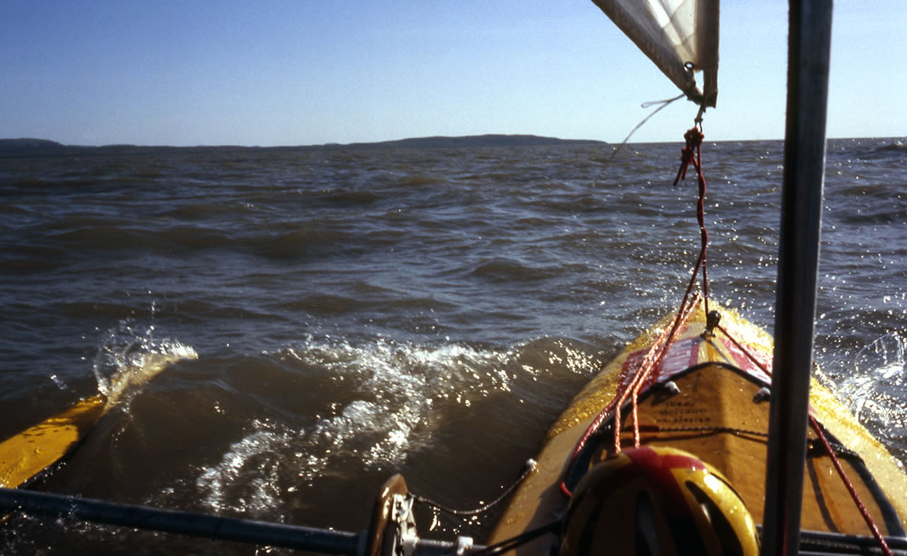
About 10 kilometres before Cape Bernier a reef jutting out seaward was being battered by breaking waves. The wind was extremely strong and with no place to land I was forced two kilometres from the coast to try to round them. Soon after monstrous waves surrounded me. In the troughs of these monsters I was often several metres down. I gripped the sail line and rudder tiller bar but the rudder was not working properly and I was unable to check it. As I surfed down the huge waves reaching incredible speeds and with little control the waves pushed me around like a cork. A wave crashed down on my deck, caving in my spraydeck and for a few moments water poured in. Time and again I plunged into huge troughs, seeing only an enormous wall of water flying in front of me. I could hardly believe that the kayak was taking so much punishment but the outriggers gave it great stability. It was one of the most frightening times of my life, but after 40 terrifying minutes the water became calmer.
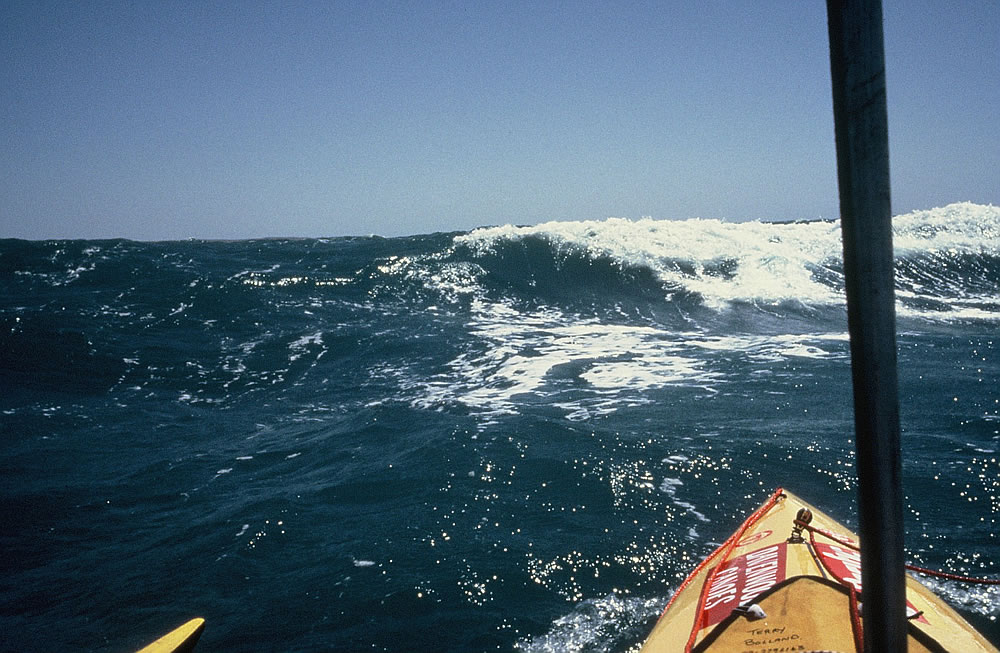
The seas near Cape Bernier became extremely rough
Entering the haven of Prince George River Harbour I was surprised to see a navy patrol boat and a yacht anchored there. A crew member on the patrol boat asked me on board to join them for a meal of steak and eggs. The patrol boat was about to go on exercises, but they were having a rest day, so most of the men were on shore fishing and having a barbeque. The skipper on the yacht behind the patrol boat, Mick turned out to be an old friend whom I had not seen for eight years.
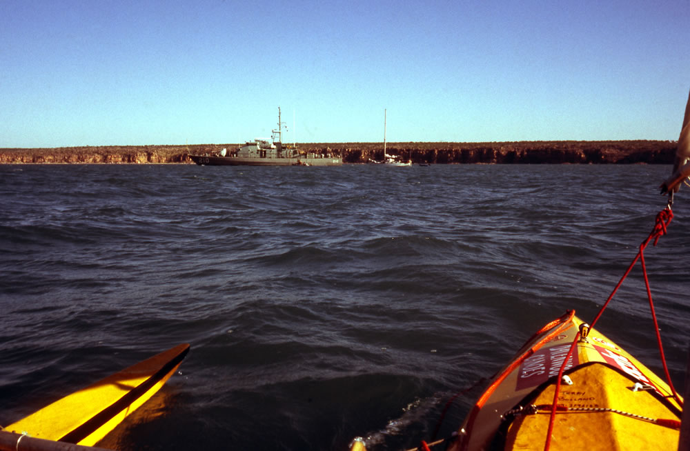
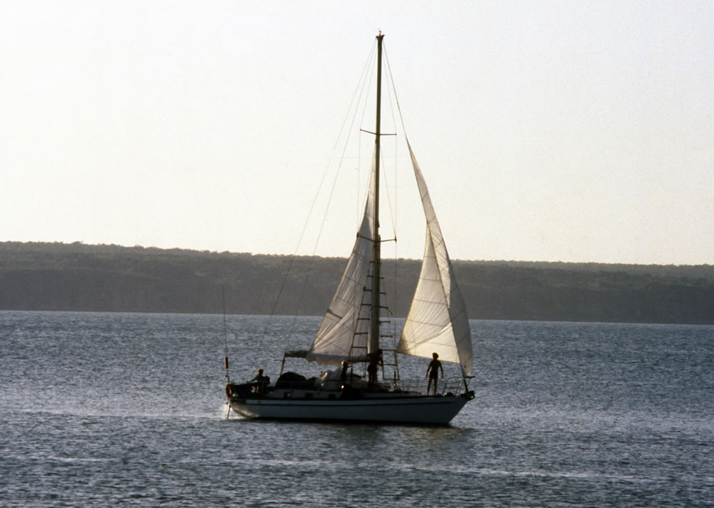
Patrol boat with a yacht tied up behind

I was treated to steak and eggs on the Patrol Boat and met a friend Mick on the yacht who I hadn’t seen for 8 years and I haven’t seen since
Later leaving the Patrol Boat with a bloated stomach I paddled over to the beach and I joined the crew of the patrol boat having their barbeque. They had been fishing all day and three sharks were left rotting near the water’s edge. Waste food left over from their barbeque was thrown in the mangroves, which made my beach a great invitation for a crocodile to visit. The Captain was young and quite tipsy. I had hoped they would be camping on the beach with me but before dusk they jumped into their boats and headed back to the Patrol Boat.
Leaving me with all their waste I was a little concerned about crocodiles visiting me during the night so I tied my hammock high in the mangroves but because of their springy nature and my weight after climbing in, I finished up very close to the ground and with no protection at all! I did however sleep with my rifle beside me wondering if I would still be alive in the morning. My dreams were not sweet…

Cliffs of the King George River

I awoke still alive which was a great relief. I had breakfast, packed up and headed upriver with the early tide to see the spectacular gorge and waterfall. Back in the bay I met up with Mick, his family and deckhand Norm Lindus. On board Mick told me a crocodile story. They were anchored near Bigge Island and a croc had spent some time watching his yacht. At midnight Mick went to relieve himself over the side of the boat when suddenly a croc leapt out of the water and tore a hole in the guard rail netting. Mick fell off balance and by the time he realised what was going on the croc leapt up again and took another mouthful out of the net. Luckily for Mick no equipment was damaged and his young children were not on deck. After that experienced he wouldn’t take a ride in his rubber ducky.
Back in February 20th, 1942 the stateship “Koolama” was bombed by Japanese planes, near Leisure Island. It then beached on a sandbar at the mouth of the King George River. The 120 passengers, officers and crew were rescued by the mission staff at Kalumburu. Twenty four hours after leaving the mission and crossing the dreaded Cape Londonderry the rescuers reached the Koolama in their lugger. Only one death was registered during the operation, that of the second radio operator who while walking between one mission and the other after the rescue, died of haemorrhage of the brain. Radio Officer F.C. Stansfield, Australian Merchant Navy died 13th March 1942 and was buried at the Kalumburu cemetery.
From King George River my next important landmark was Cape Londonderry, where 25 kilometres of reef followed the coastline and extended up to 12 kilometres out to sea. After just experiencing very rough conditions along the coast around the previous set of reefs, I was hoping that this longer section of reef would not be as horrendous as the last one. To my surprise the sea was very calm as I rounded Cape Londonderry, so calm I was unable to use the sail. After seven hours of paddling I was relieved to have cleared the dangerous reefs. At Cape Talbot a crocodile, a dingo, flocks of white Torres Straight pigeons and a north-westerly breeze (which signalled the change in weather pattern) greeted me.
Chased by sharks, I took three days to reach Kalumburu Mission, which was at the south end of Napier Broome Bay and 15 kilometres up the King Edward River. Here I arranged to collect my food parcels from the local schoolteachers, John and Marie Brailey who invited me to stay a few days.
Kalumburu..
It was in 1908 when the Benedictine church founded a mission at Drysdale River and transferred definitely to Kalumburu in 1936. In 1982 the Benedictine church sold the mission land to the government. Now the church runs the small mission grounds, which includes the church, mission quarters, store, kindergarden, radio communications room, office and bakery.
Kalumburu April 1944..
This month of April was the busiest yet, 367 movements taking place on this aerodrome. Approximately 250 operational hours were flown from Drysdale resulting in approximately 60,000lbs of bombs being dropped on enemy territory and the morale of the Unit was greatly enhanced by the increased activity.D.S. Askew, Flight Lieutenant, Commanding No 58 Operational Base Unit.
June 1944..
Operations from this strip were greatly curtailed during the past month owing to the intended transfer of the Unit from Drysdale to Truscott. The completion of the move from Drysdale to Truscott is eagerly awaited by all. Total aircraft movements on the strip for the month were 180 S.S. Evans, Squadron Leader.
Even after the transfer of the Unit from Kalumburu to Truscott the mission and the Aboriginal workers carried on playing an important role during the remainder of the war.
After four days I left Kalumburu and the hospitality of John, Marie and the Aboriginal community and headed north towards Sir Graham Moore Island. At Kalumburu the Aboriginal elders warned me not to eat fish or eat seafood inbetween Louis Islands and Mary Island which was on the Western side of the Anjo Pennisular. Apparently a long time ago, one of their people had been poisoned after eating fish from the region. I’m not superstitious but I decided to take their advice just in case.
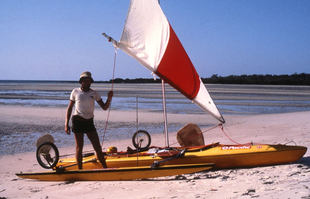
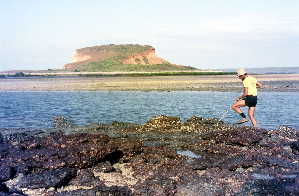
Low tide on a beach opposite Mary Island. It was a long walk from the water’s edge
Low tide on a beach opposite Mary Island
I camped for the night near Elbow Point overlooking the Sir Graham Moore Islands, but there were no trees in which to tie my hammock. In the war there were two units stationed on Sir Graham Moore Islands, one American (Lourain) and the other Australian (Radar). The only evidence that remained of their visit were a few drums, some other discarded equipment and several wild pigs.
At midnight I awoke with violent pains in my stomach, feeling sick and a need to rush to the loo. I had diarrhoea so my backside was exposed to the sand flies for ages. They were cruel, they took advantage of my ill health and viciously attacked without mercy every part of my exposed flesh.
Throughout the night I vomited and had diarrhoea and as daylight broke I felt dizzy and distressed. No matter how bad I felt I knew I had to move away from the millions of sand flies that ravaged me the previous night.
I paddled on with a hammering head and churning stomach, wanting to pass Mary Island by nightfall, but the falling tide left a huge expanse of sand flats high and dry between the island and the mainland so I didn’t quite make it.
Luckily my diarrhoea had stopped, as it wouldn’t have been pleasant going to the toilet from the kayak. To help restrict my bowel movements I ate a large portion of damper.
By the time I reached a beach on the west side of Anjo Peninsular a few kilometres from the abandoned Truscott Airbase I felt fine. What made me sick is still a mystery but I am glad it only lasted one day.
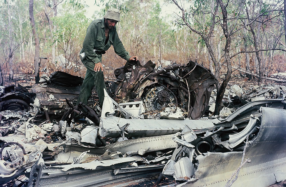
To reach the airbase I had to walk several kilometres inland through the bush. When I reached the airfield parts of the airstrip was in good condition, but much of it was overgrown by wattle trees. A crashed B24 Liberator aircraft, a communication tower and other derelict equipment lay near the runway. Hundreds of steel mats littered the airstrip and 44 gallon drums were scattered about.
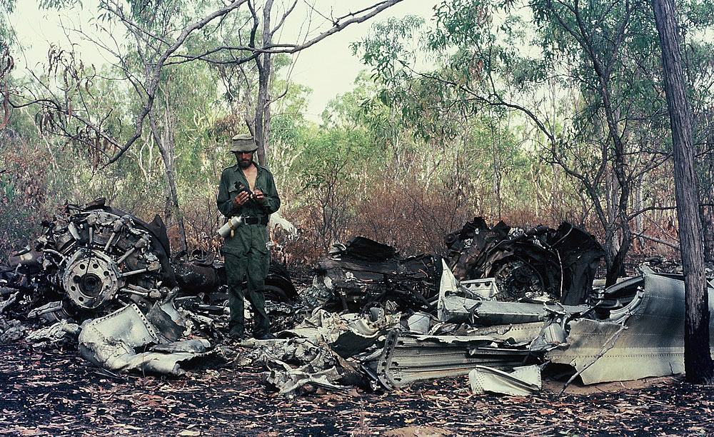
Exploring Truscott abandoned air base
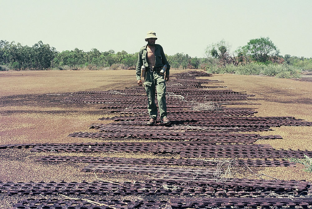
The runway was littered with steel mats
When I finished exploring and with replenished water supplies I left Truscott deserted air base and crossed Vansittart Bay to the rugged coastline of Cape Bougainville, which has several bays and points that looked like a rugged 10 leaf clover. I was very lonely paddling towards the cape but a shark woke me up from my trance with splashes and attacks on my rudder.
The Eclipse Islands lay at the entrance of Vansittart in a northerly direction. They were so named by Captain King in consequence of an eclipse of the moon in the evening of October 21st 1819.
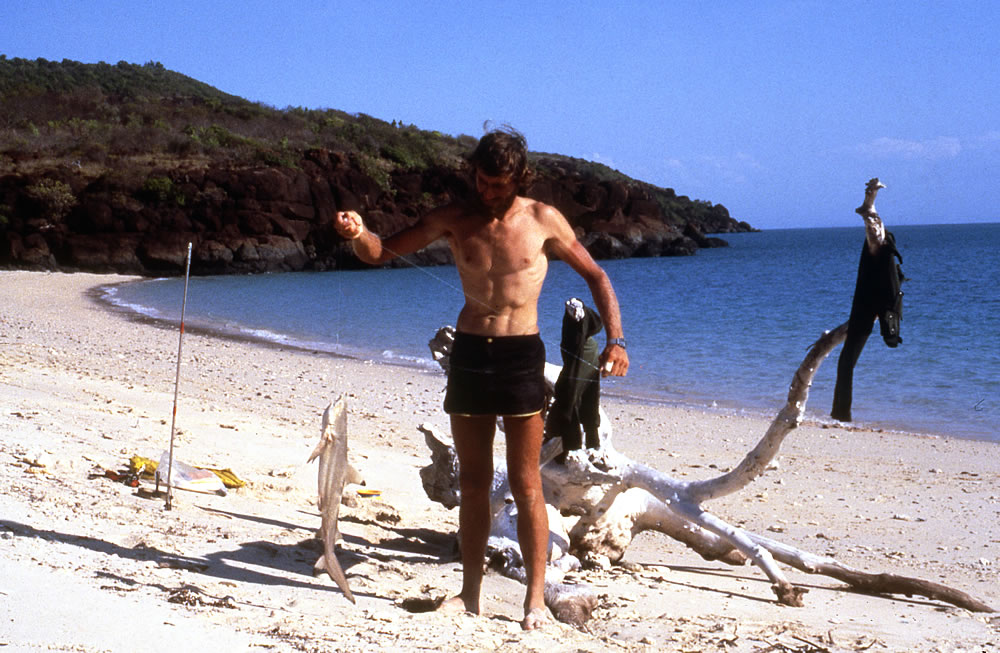
Shark for dinner
At Cape Bougainville I explored a gully that I was told might contain water. Because of the extreme heat I needed to replenish my water supplies as often as possible. The creek below the gully was a picture of death. The dry bed, encrusted with salt, lacked even the smallest living creatures and the un-healthy-looking mangroves only gave refuge to debris brought up on a high tide. I found a shallow pool of water in the gully which turned out being kangaroo urine. Unsuccessful in finding water I returned to Cape Bougainville.
Hat Point used to be a very important landmark for the missionaries at Kalumburu. Here they used to tranship food and goods from small ships to the Kalumburu Mission lugger, which then took supplies to Kalumburu. It was too dangerous for the ships to go past Cape Bougainville because of the many dangerous reefs.
Hunting for sea food
At Hat Point, south of Cape Bougainville, my water supplies were low, so I started producing my own water from four of my salt-water stills. Water is a sparse commodity at this time of the year. The rains had passed several months earlier and the fiery heat soon evaporated what lay in pools or small creeks. The weather conditions were becoming unbearable, it was very hot and humid. To add to the tropical heat, the dew made things very uncomfortable. As soon as the sun dropped everything became damp. No matter what I did my clothes were never dry, when walking they were soaked in sweat, at night they were drenched in dew.

The Cape Bougainville bauxite deposits are lateritic plateau type. The group of deposits is composed of three major plateaus each about 23km square in surface and 16 other plateaus of variable sizes. The geology is similar to that of the Mitchell Plateau (see below), derived from the Carson volcanics, a basic extrusive. These deposits have a medium to high available alumina content. Reactive silica levels are moderate to high. No exploration work has been carried out on the mining leases since the late 1970’s, partially due to ongoing negotiations and regulatory requirements in regard to the Indigenous Traditional Owners. The original owner, AMAX, completed minor drilling from 1966 to 1972. No exploration has been undertaken since then. There are no infrastructure facilities and equipment of note. Costs have been included in Mitchell Plateau costs
A good landing spot but no room to camp on a high tide

Distilling salt water
I left Hat Point knowing that I could not waste too many days before finding water and as I paddled across the silent glassy sea again, sharks started following me. I headed towards two un-named rivers. There were no beaches to camp on so when the tide allowed, I landed on a rock ledge, one kilometre from the nearer river. I settled in and then took off for a walk towards the river. The walk was not easy as I had to fight through chest deep spinifex, wattle thickets, ravines, large boulders and mangroves. The agonizing walk took an hour, and the return trip carrying water in the blistering heat, was even more painful. As I hadn’t washed in fresh water for two weeks, it was a welcome relief.
Dragging the kayak up onto the rock and above the high tide
All my gear has to be taken out of the kayak before moving it.
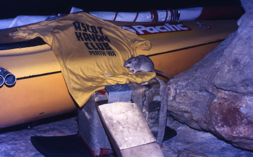
A friendly rat kept coming to visit. There were also quolls

Time for a freshwater dip

A fresh water crocodile

For three days I explored the river and surrounding bush. Birds, lizards, fish, oysters and other shell fish and animals were abundant. In such a vast inhospitable wilderness, places like these would be very important if I became stranded. Here, the crocodiles were so cheeky that they slept only a few metres below my rock ledge. It was good to have a home for a few days to relax, bathe in fresh water, explore and to hunt for sea food. I now could drink as much as I wanted and didn’t have to ration it.
Refreshed, I continued on the last leg of my journey to Mitchell Plateau. Within a few kilometres I sighted my first sea snake, and saw more sharks, turtles and dolphins. As I paddled closer to the plateau, passing the Osborn Islands the terrain became familiar, as it was less than a year since I had last paddled these waters.
On arrival at Port Warrender I met ten people in three four-wheel drives vehicles. The canoeing part of my trip was over but I had to get my kayak back to Derby so a spare roof rack and $100.00 soon solved that problem, and the kayak was spared the burial that its predecessor received the previous year.
Once my kayak was gone my plan was to explore the Mitchell Plateau area by foot walking from Port Warrender across to Surveyors Pool and onto the Mitchell River. After several days’ walking I arrived at the tidal section of the Mitchell River not far from a four tiered waterfall and camped under the overhang. The following day, to my surprise, a couple with two dogs walked into my camp and started chatting. Gordon and Heather spent a lot of time exploring the Kimberley region and were true bush people. A little later we walked to the tidal waters and on spotting a school of fish Gordon quickly picked up a rock and threw it into the school and stunned a fish. Dinner was soon collected.
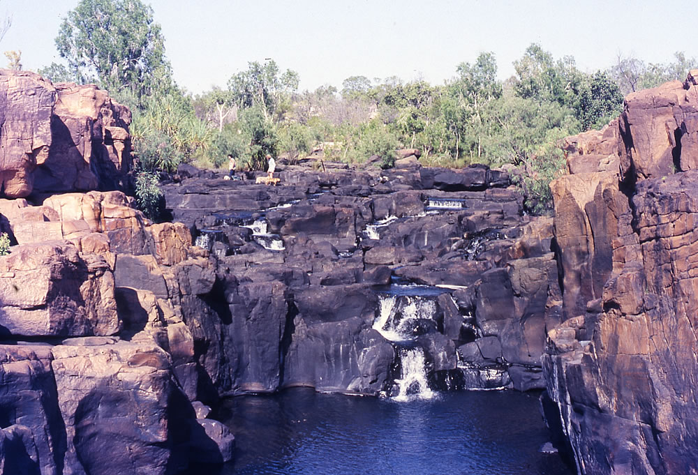
The Twin Falls near the salt water section of the Mitchell River
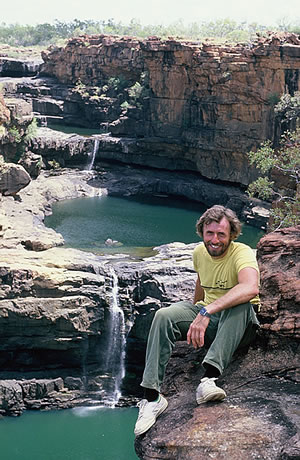
Leaving Gordon and Heather the following day I set off across country to another beautiful smaller gorge which had a waterfall, abundant animals, fish and green ants that dropped from bushes and inflicted terrible bites. Then my last major goal on this trip was to head back to Mitchell Falls, a magnificent stream of water that tumbled over a hundred metres. The falls are one of the most spectacular I have ever seen and although I had seen them before I was still extremely impressed.
Mitchell Falls
Fifty four days after starting my expedition, I again met up with Gordon and Heather near Mitchell Falls and they kindly offered me a lift back to Derby which was just perfect. They were keen cave painting explorers and bush survivalists and fishers so on our way back to Derby we detoured several times to explore many rivers to find Aboriginal cave paintings and to catch several huge barramundi fish. When we arrived in Derby two weeks later we found out that Australia had won the America’s cup and a Korean Airliner had been shot from the sky.
